Sites: news | india | latam | brasil | indonesia
Feeds: news | india | latam | brasil | indonesia
topic: Satellite Imagery
Social media activity version | Lean version
Despite drought, Amazon deforestation alerts hit five-year low
- The Brazilian Amazon experienced a 47% decrease in deforestation in April compared to last year, marking the lowest level in five years, and a 51% decrease over the past 12 months.
- Since President Luiz Inácio Lula da Silva took office in January 2023, his administration has effectively curbed deforestation by reinstating conservation programs, strengthening environmental agencies, and supporting Indigenous rights.
- The decline in deforestation occurred despite a severe drought affecting the region, which includes record fires in the state of Roraima.
AI model maps global tree canopy heights in hi-res, with carbon counting in mind
- Scientists have used high-resolution satellite images to create a map of global canopy heights, and to also develop an AI model that can predict canopy heights.
- Tech company Meta collaborated with nonprofit organization World Resources Institute to develop the open-source map and model.
- While the map aims to establish and serve as a baseline for conservation initiatives, the AI model could be used to predict canopy heights in areas where high-quality data aren’t available.
- Canopy height is an important indicator of forest biomass and aboveground carbon stock, and is used to measure the progress of forest restoration efforts.
Wildlife from space: Winners of Satellites for Biodiversity Award named
- The winners of the second edition of the Satellites for Biodiversity Award have been announced.
- The winners include conservation initiatives that use satellite data to monitor and protect wildlife such as chimpanzees, bears, wolves and rhinos in South Sudan, Peru, Ethiopia and Nepal respectively.
- The award was launched in December 2022 as a partnership between the Airbus Foundation and U.K.-based nonprofit the Connected Conservation Foundation.
- The winners of the award will be granted access to Airbus’s high-resolution satellites as well as funding and training from the Connected Conservation Foundation.
Deforestation alerts in the Brazilian Amazon fall to a 5-year low
- Forest clearing detected by Brazil’s deforestation alert system fell to the lowest level in nearly five years.
- According to data released last week by the country’s space agency, INPE, deforestation registered over the past twelve months amounts to 4,816 square kilometers, 53% below the level this time last year.
- The drop in deforestation has occurred despite a severe drought affecting much of the Amazon basin.
Protected areas bear the brunt as forest loss continues across Cambodia
- In 2023, Cambodia lost forest cover the size of the city of Los Angeles, or 121,000 hectares (300,000 acres), according to new data published by the University of Maryland.
- The majority of this loss occurred inside protected areas, with the beleaguered Prey Lang Wildlife Sanctuary recording the highest rate of forest loss in what was one of its worst years on record.
- A leading conservation activist says illegal logging inside protected areas is driven in part by demand for luxury timber exports, “but the authorities don’t seem to care about protecting these forests.”
- Despite the worrying trend highlighted by the data, the Cambodian government has set an ambitious target of increasing the country’s forest cover to 60% by 2050.
New technologies to map environmental crime in the Amazon Basin (commentary)
- Environmental crimes like land grabbing, illegal deforestation, and poaching hinder climate action, deter investment in sustainable practices, and threaten biodiversity across major biomes worldwide.
- Despite challenges such as vast territories difficult to police and weak rule of law, new technologies like geospatial and predictive analytics are being leveraged to enhance the detection and disruption of these activities.
- Innovative approaches, including public-private partnerships and AI tools, show promise in improving real-time monitoring and enforcement, although they require increased investment and training to be truly effective, argue Robert Muggah and Peter Smith of Instituto Igarapé, a “think and do tank” in Brazil.
- This post is a commentary. The views expressed are those of the authors, not necessarily Mongabay.
Fires surge in the Amazon, but deforestation continues to fall
- Deforestation in the Brazilian Amazon has continued on a downward trajectory despite a sharp increase in fires associated with the severe drought in the region.
- According to data published by Brazil’s National Space Research Institute (INPE) earlier this month, forest loss in the Brazilian Amazon amounted to 5,010 square kilometers over the past twelve months, the lowest level recorded since May 2019.
- Despite the declining rate of forest loss, fires in the Amazon are on the rise, driven by the severe drought gripping the region.
- Deforestation in the Brazilian Amazon has fallen precipitously since Luiz Inácio Lula da Silva replaced Jair Bolsonaro as president last year.
2024 outlook for rainforests
- Last week, Mongabay published a recap of the major trends in the world’s tropical rainforests for 2023.
- Here’s a brief look at some of the key issues to monitor in 2024.
- These include: Brazil, elections in DRC and Indonesia, forest carbon markets, el Niño, global inflation and commodity prices, advancements in forest data, and progress on high level commitments.
In Laos, forest loss and carbon emissions escalate as agriculture intensifies
- Shifting cultivation is expanding into intact forest frontiers in Laos, triggering a spike in associated carbon emissions, according to a new study based on satellite data.
- As the dominant land use type in Laos, shifting cultivation has affected roughly one-third of the country’s total land area over the past three decades, the study says.
- The study also highlights how fallow land, a vital carbon store in Laos, is increasingly undermined by farming practices characterized by shorter fallow periods.
- The authors say their data can be used by policymakers to design programs that support more sustainable forms of shifting cultivation. Experts urge that such interventions sensitively consider why remote communities might be forced to transition away from traditional, subsistence-based farming toward intensified systems.
Deforestation falls for 8th straight month in the Amazon rainforest, but rises in the cerrado
- Deforestation in the Brazilian Amazon has decreased for the eighth consecutive month, but damage is rising in the cerrado, a tropical woody grassland that’s adjacent to Earth’s largest rainforest.
- According to data released today by Brazil’s National Space Research Institute (INPE), forest clearing in November totaled 201 square kilometers, bringing the cumulative loss for the past 12 months to 5,206 square kilometers – 51% less than last year.
- The decline in deforestation has persisted despite one of the most severe droughts ever recorded in the Amazon.
- However, while deforestation in the Amazon rainforest has decreased, it has reached the highest level in at least five years in the cerrado.
Deforestation in the Brazilian Amazon falls 22% in 2023
- Deforestation in Earth’s largest rainforest decreased by 22% in the year ending July 31, 2023, according to data released on Thursday by Brazil’s National Space Research Institute (INPE).
- INPE’s analysis of satellite imagery found that forest clearing in the Brazilian Amazon totaled 9,001 square kilometers, an area approximately the size of Puerto Rico.
- INPE’s estimate is preliminary. Final data for the “deforestation year” is expected to come out in the second quarter of 2024.
- Nevertheless, the data is seen as a sign that President Luiz Inácio Lula da Silva’s efforts to curb deforestation is having an effect after a period of rising forest loss under Jair Bolsonaro.
Indonesia’s besieged Tesso Nilo National Park hit hard by yet more deforestation, satellites show
- Sumatra’s Tesso Nilo National Park boasts one of the highest levels of lowland plant diversity known to science and harbors an estimated 3% of the planet’s mammal species.
- But industrial tree plantations, encouraged by the COVID-19 pandemic and boosted by high palm oil prices, are quickly supplanting the park’s remaining habitat.
- Satellite data show the park lost 87% of its primary forest cover between 2002 and 2022, most of which was cleared after the government expanded Tesso Nilo’s boundaries in 2009
- Preliminary data from GFW, along with satellite imagery, indicate 2023 has been another particularly bad year for the park’s remaining habitat, with clearings nearly severing Tesso Nilo’s last large tract of forest by September.
Despite severe drought, Amazon deforestation continues to slow
- Despite a severe drought, deforestation in the Brazilian Amazon is still on the decline, according to data released today Brazil’s national space research institute (INPE).
- INPE’s near-real-time deforestation monitoring system, DETER, detected 629 square kilometers of forest clearing in September, a 57% drop from last September.
- This decline in forest loss has occurred despite a severe drought that is affecting vast swathes of the Brazilian Amazon, drying up rivers and worsening the spread of agricultural fires.
Applications open for Airbus’s ‘Satellites for Biodiversity Award’
- The second edition of the “Satellites for Biodiversity Award” has been announced by the Airbus Foundation and the Connected Conservation Foundation.
- The two organizations are accepting applications until Dec. 15 for an award to support the use of high-resolution satellites for monitoring, tracking and protecting global biodiversity.
- Winners will receive access to Airbus’s high-resolution Pléiades and Pléiades Neo satellites, along with access to global mapping software from Esri and funding of $6,000.
- Previous winners include a project to map elephant habitats in Sai Yok National Park in Thailand, and community-led efforts to use drones and satellites to save tree kangaroos in Papua New Guinea.
Protected areas a boon for vertebrate diversity in wider landscape, study shows
- A new study reveals that protected areas in Southeast Asia not only boost bird and mammal diversity within their confines, but they also elevate numbers of species in nearby unprotected habitats.
- The researchers say their findings back up the U.N.’s 30×30 target to protect 30% of Earth’s lands and waters by 2030.
- The findings indicate that larger reserves result in more spillover of biodiversity benefits into surrounding landscapes. The authors call on governments to invest in expanding larger reserves over the proliferation of smaller ones.
- Conservationists say that while expanding protected area coverage is part of the solution, serious investment in management and resourcing for existing protected areas is a matter of urgency to ensure they are not simply “paper parks.”
Mexico groups say Maya Train construction has caused significant deforestation
- An analysis of satellite images by the NGO CartoCrítica shows that 10,831 hectares (26,764 acres) are currently being used for the Maya Train project, with 61% of the area deforested.
- The organization’s survey also reveals that in 87% of the deforested lands, clearing or logging was carried out without a change of land use approval, as required by environmental legislation.
- Mexico’s Secretariat of Environment and Natural Resources (SEMARNAT) has issued a statement saying the figures presented contain “inconsistencies.” But the organizations that carried out the analysis point out that their deforestation data is supported by satellite evidence.
Deforestation in the Amazon rainforest continues to plunge
- Deforestation in the Brazilian Amazon continues to decline, according to data released today by Brazil’s national space research institute, INPE.
- INPE’s deforestation alert system indicates that forest clearing in Brazil’s portion of the Amazon in August declined 66% compared to the same month last year.
- Deforestation in the Brazilian Amazon has seen a decrease for five consecutive months. This follows President Luiz Inácio Lula da Silva’s commitment to curb the escalating forest loss in the region.
- Brazil is set to release its annual assessment of deforestation for the year ending July 31 in the coming weeks.
How the Amazon’s ‘greatest devastator’ sold cattle to a Carrefour supplier
- Arrested by Brazilian Federal Police, cattle rancher Bruno Heller and relatives have already received over $5 million in environmental fines. He is also suspected of land grabbing.
- Heller transported cattle from a family farm fined for environmental violations to two other properties free from environmental implications — this maneuver is an indication of the so-called “cattle laundering.”
- A Frialto Group meatpacking plant confirmed that it slaughtered 249 animals for the Heller family. The facility supplies Carrefour, but the French retail company states that the meat from animals raised by Heller did not reach its supermarkets.
Amazon deforestation continues to fall under Lula
- Deforestation in the Brazilian Amazon plunged sharply in July, continuing a downward trend since President Luiz Inácio Lula da Silva took office at the beginning of the year.
- The analysis of satellite data from Brazil’s national space research institute showed that 500 square kilometers (193 square miles) of tropical rainforest were cleared in Brazil’s portion of the Amazon during the month of July. This represents a 66% decline relative to July a year ago when Jair Bolsonaro was president.
- The news comes just days before leaders from eight Amazonian nations will meet in Belém to discuss ways to protect and sustainably manage Earth’s largest rainforest.
- The decline in Brazil’s rate of deforestation marks a sharp reversal relative to the trend under the Bolsonaro Administration, during which forest destruction surged.
Poverty-fueled deforestation of Nigerian reserve slashes hope for rare chimps
- Less than 20 year ago, Akure-Ofosu Forest Reserve was regarded as a potential conservation site for endangered Nigeria-Cameroon chimpanzees.
- But between 2001 and 2022, the reserve lost nearly half of its old growth forest cover, a trend that shows no sign of stopping.
- Akure-Ofosu’s forest is being lost due to the proliferation small-scale farms within the reserve.
- Facing an unemployment rate surpassing 50% and a soaring level of poverty, many Nigerians have few options other than to settle in the country’s protected areas and hew farms from forest.
Six months into Lula’s presidency, Amazon deforestation is dropping rapidly
- The rate of deforestation in the Brazilian Amazon has fallen significantly since Luiz Inácio Lula da Silva took office in January 2023, according to government data.
- The area of deforestation detected by INPE’s forest monitoring system amounted to 2,649 square kilometers in the first half of the year, a 34% decline last year.
- Lula has prioritized reining in deforestation since assuming the presidency. Last month, he announced his administration’s plan to eliminate deforestation by 2030 as part of Brazil’s pledge to reduce greenhouse gas emissions.
The Amazon saw record deforestation last year. Here’s why.
- An estimated 1.98 million hectares (4.89 million acres) of forest were cleared in 2022, a 21% increase from 2021.
- It was the worst year for deforestation since 2004, according to Amazon Conservation’s Monitoring of the Amazon Project (MAAP), which analyzed satellite readings from Global Forest Watch.
- The deforestation was caused by cattle ranching, agriculture, mining and road projects in Brazil, Bolivia, Peru, Colombia, Ecuador and Venezuela.
New digital tool maps blue carbon ecosystems in high resolution
- The Blue Carbon Explorer, a digital tool developed by the nonprofit Nature Conservancy and the Earth-imaging company Planet, combines satellite imagery, drone footage and fieldwork to map mangroves and seagrass in the Caribbean, Papua New Guinea and Indonesia.
- The tool aims to help scientists, conservationists and governments gauge mangrove health and identify areas in need of restoration.
- The Blue Carbon Explorer comes at a time of growing interest in blue carbon ecosystems as potential nature-based solutions for climate change.
3 million hectares of Colombian Amazon deforested for illegal pasture: Study
- One of the main challenges that comes with analyzing satellite images is establishing whether a change in land use has taken place legally or illegally.
- A recent study, published in Nature magazine, used a new methodological approach that allowed the researchers to identify which areas had undergone illegal changes in land use between 1984 and 2019.
- Deforestation for the creation of pasture for illegal cattle ranching has seen an unprecedented, exponential increase since 2017.
- The researchers also said there is a good chance of restoring forest cover in areas that were once used for coca farming, meaning it would avoid the same fate as forested land that has been lost to illicit cattle ranching.
New study reveals fine detail on location and scale of mining sites worldwide
- Researchers pored over satellite imagery to create one of the most comprehensive data sets on the global mining footprint ever generated.
- The data set, which is publicly available, maps out in fine detail the boundaries of a combined 65,585 km2 (25,323 mi2) of mining sites across the world.
- Nearly 10% of the total mining areas mapped in the study fell inside protected areas like national parks, Ramsar wetlands and UNESCO World Heritage Sites.
- The study’s authors say they hope the data set will prove useful to other researchers, investigators and journalists looking to understand and predict the impact of global mineral supply chains.
Return of the GEDI: Space-based, forest carbon-mapping laser array saved
- Since 2018, the GEDI mission has been firing lasers from the International Space Station to measure aboveground biomass on Earth.
- The information gleaned from it has been crucial for scientists to understand how deforestation contributes to worsening climate change.
- The mission was supposed to be decommissioned earlier this year, with the lasers fated to be jettisoned from the ISS and burned up in the atmosphere.
- However, NASA made a last-minute decision to extend the mission after a push from the scientists involved in it: the GEDI equipment will be put into storage for 18 months, then reinstated to resume operations for as long as the ISS continues to run.
Scientists map nearly 10 billion trees, stored carbon, in Africa’s drylands
- A recent study has mapped the locations of 9.9 billion trees across Africa’s drylands, a region below the Sahara Desert and north of the equator.
- The research, which combined satellite mapping, machine learning and field measurements, led to an estimate of 840 million metric tons of carbon contained in the trees.
- This figure is much lower than the amount of carbon held in Africa’s tropical rainforests.
- However, these trees provide critical biodiversity habitat and help boost agricultural productivity, and this method provides a tool to track both degradation and tree-planting efforts in the region.
Airbus Foundation looks to put satellites to new biodiversity conservation uses
- The Connected Conservation Foundation and the Airbus Foundation are currently accepting proposals for an award to support the use of satellite imagery for biodiversity conservation.
- The competition winners will receive access to Airbus’s Pléiades and Pléiades Neo satellite constellations and $5,000 in financing.
- The satellites deliver images with resolutions down to 30 centimeters (12 inches) and could be used in applications such as anti-poaching, forest monitoring, and species population assessments.
Despite 11% drop in 2022, Amazon deforestation rate has soared under Bolsonaro
- An area equivalent to the size of Qatar was cleared in the Brazilian Amazon between Aug. 1, 2021, and July 31, 2022, according to data from the country’s National Space Research Institute (INPE).
- Although the figure represents an 11.27% decrease in the Amazon annual deforestation rate compared with the prior year, the government of President Bolsonaro still accounts for the most Amazon destruction in the last 34 years, environmentalists say.
- Bolsonaro’s four-year term ends with a 59.5% boom in Amazon deforestation rates, the highest in a presidential term since 1988, when measurements by satellite imagery began.
- INPE’s report, dated Nov. 3 but only released 27 days later, also triggered criticism among environmentalists, who accused the Bolsonaro’s administration of omitting the annual deforestation data until the end of the UN conference on climate change, COP27, held Nov. 6-20 in Egypt.
In final days before Bolsonaro’s defeat, deforestation boomed in Brazil
- According to data published today by Brazil’s national space research agency INPE, deforestation in the Brazilian Amazon amounted to 904 square kilometers in October, a 3% increase over last year.
- Year to date, INPE’s deforestation alert system has detected 9,494 square kilometers of forest clearing, 20% more than 2021.
- The figures came less than two weeks after Luiz Inácio Lula da Silva narrowly defeated Jair Bolsonaro in a run off election. Lula, who presided over a sharp drop in Amazon forest deforestation during his terms in office between 2003 and 2010, made saving the Amazon a key part of his bid for the presidency.
- In contrast, Bolsonaro has overseen a steep rise in deforestation, which hit a 15-year high last year.
Amazonian river communities seek to boost hard-won land rights to fight loggers
- In March, 15 traditional communities on the Rio Manicoré in the state of Amazonas were granted a collective concession for the rights to sustainably use their land — the first of its kind in the state.
- Some members of these communities have been working since 2006 to turn their territory into a sustainable development reserve, which would bring greater protection against logging and mining.
- But a hostile campaign waged by illegal loggers and miners means the push for reserve status isn’t supported by most community members.
- The Rio Manicoré region is considered one of the best-preserved parts of the Brazilian Amazon, but since 2015 deforestation rates have hit record levels.
Ahead of election, deforestation increased in Brazil
- Deforestation in the Amazon rainforest is surging ahead of the presidential election in Brazil.
- According to data released today by Brazil’s national space research agency INPE, deforestation in the Brazilian Amazon topped 1,450 square kilometers in September, a 48% increase over last year.
- Deforestation through the first nine months of 2022 has amounted to 8,590 square kilometers, the highest such tally on record since the current deforestation alert system was established in 2007.
New tech aims to track carbon in every tree, boost carbon market integrity
- Climate scientists and data engineers have developed a new digital platform billed as the first-ever global tool for accurately calculating the carbon stored in every tree on the planet.
- Founded on two decades of research and development, the new platform from nonprofit CTrees leverages artificial intelligence-enabled satellite datasets to give users a near-real-time picture of forest carbon storage and emissions around the world.
- With forest protection and restoration at the center of international climate mitigation efforts, CTrees is set to officially launch at COP27 in November, with the overall aim of bringing an unprecedented level of transparency and accountability to climate policy initiatives that rely on forests to offset carbon emissions.
- Forest experts broadly welcome the new platform, but also underscore the risk of assessing forest restoration and conservation projects solely by the amount of carbon sequestered, which can sometimes be a red herring in achieving truly sustainable and equitable forest management.
Amazon deforestation in Brazil booms in August
- Rainforest destruction in the Brazilian Amazon jumped 11% in August with deforestation reaching 1,661 square kilometers (641 square miles) — an area more than 28 times the size of Manhattan — according to data released today by Brazil’s national space research agency, INPE.
- The tally brings rainforest clearing detected in the Brazilian Amazon since the beginning of the year by INPE’s deforestation alert system to 7,135 square kilometers, the highest on record dating back to 2008.
- About 80% of August’s deforestation occurred in just three states: Para (41%), Mato Grosso (20%), and Amazonas (19%).
- Deforestation in the Brazilian Amazon has been trending higher since 2012 and has especially accelerated since 2019, when Jair Bolsonaro became president.
Indepedent watchdog confirms rampant deforestation in the Amazon
- Data from independent forest monitoring group Imazon has confirmed that deforestation in Earth’s largest rainforest is on track to approach the highest level in 15 years.
- Imazon’s monthly deforestation alert system detected 10,781 square kilometers of forest clearing in the Brazilian Amazon betwen August 2021 to July 2022, a 3% rise over the same period last year when forest destruction reached the highest level since 2006.
- Imazon’s update came shortly after INPE, Brazil’s national space research institute, published its own deforestation alert-based data.
- Deforestation in the Brazilian Amazon has been on an upward trend since 2012.
Amazon deforestation on pace to roughly match last year’s rate of loss
- Deforestation in Earth’s largest rainforest is on track to rival last year’s 15-year-high according to data released today by the Brazilian government.
- INPE, Brazil’s national space research institute, today published figures from its DETER deforestation alert system, which tracks forest clearing on a near-real time basis. INPE’s system detected 8,590 square kilometers of deforestation between August 1, 2021 and July 31, 2022, 2.3% lower than the previous year, when deforestation hit the highest level since 2006.
- The area of forest affected by degradation and selected cutting, which is typically a precursor to outright deforestation, climbed 15.6% year over year.
- 2022’s tally represents an area nearly the size of Puerto Rico or Cypress. But the actual area of forest loss over the past 12 months is significantly higher: INPE is expected to release its findings from analysis of high resolution satellite imagery in October or November.
Amazon deforestation is off to the fastest start to a year since 2008
- Deforestation in the Brazilian Amazon is off to the fastest start for the first half of any year since 2008 according to government data published today.
- Deforestation alert data from Brazil’s national space research institute INPE shows that 3,988 square kilometers of forest have been cleared within the Brazilian Amazon since January 1, a 17 percent rise over last year.
- Deforestation in the Brazilian Amazon reached a 15-year high in 2021.
Satellites show deforestation surging in Indonesia’s Tesso Nilo National Park
- Tesso Nilo National Park is a refuge for Sumatran wildlife, including critically endangered tigers and elephants.
- But the park lost 67% of its primary forest between 2010 and 2021, with the deforestation rate in 2021 nearly triple that of 2020 and the highest it has been since 2016. Satellite imagery shows further clearing of primary forest in 2022.
- Much of the deforestation of Tesso Nilo is due to the illegal development of large-scale plantations to grow oil palm and other tree crops.
- In early 2022, park officials distributed a circular to surrounding communities that reiterated the ban on plantation agriculture in the park, but conservationists say more concerted enforcement action is necessary to curb deforestation.
New near-real-time tool reveals Earth’s land cover in more detail than ever before
- A new tool co-developed by Google Earth Engine and the World Resources Institute is being billed as the planet’s most up-to-date and high-resolution global land cover mapping data set, giving unprecedented levels of detail about how land is being used around the world.
- The launch of the tool this week marks a big step forward in enabling organizations and governments to make better science-based, data-informed decisions about urgent planetary challenges, the developers say.
- Named Dynamic World, it merges cloud-based artificial intelligence with satellite imagery to give near-real-time global visualizations of nine types of land use and land cover.
- The tool is likely to be important for a variety of purposes, the developers say, such as monitoring the progress of ecosystem restoration goals, assessing the effectiveness of protected areas, creating sustainable food systems, and alerting land managers to unforeseen land changes like deforestation and fires.
Amazon deforestation surges in April
- Deforestation in the Brazilian Amazon exceeded 1,000 square kilometers in April, the highest total since 2008 and roughly twice the level of April 2021, according to data released today by Brazil’s national space research institute INPE.
- The loss — which only accounts for the first 29 days of the month — put deforestation in the Brazilian Amazon through the first four months of 2022 at 1,953 square kilometers as the region heads into the peak deforestation season.
- Last year deforestation topped 13,000 square kilometers for the first time since 2006.
- Scientists have warned that the Amazon may be approaching a tipping point where vast areas of rainforest transition to a woody savanna.
Where satellites come up short, drones can fill in a picture of our oceans
- Marine researchers are increasingly turning to aerial drones for a new view of the ocean, given that their resolution is much finer than that of satellites.
- While drones are used in all kinds of ways in marine studies, researchers say drones can be equipped with special sensors to track small changes in the ocean’s movements that drive much of marine life.
- Drones could be especially helpful in finding and tracking local and dangerous algae blooms, for example.
- Researchers remain hindered by regulations and cost, but that hasn’t stopped them from using drones to increase our knowledge of our blue planet.
Deforestation on the rise as poverty soars in Nigeria
- Akure-Ofosu Forest Reserve was established to help protect what is now one of largest remaining tracts of rainforest in Nigeria, and is home to many species.
- But fire and logging is rampant in the reserve, with satellite data showing it lost 44% of its primary forest cover in just two decades; preliminary data indicate deforestation may be increasing further in 2022.
- Sources say poverty is the driving force behind the deforestation of Akure-Ofosu and other protected areas in Nigeria.
- According to the World Bank, 4 in 10 Nigerians – about 80 million people – were living below in poverty in 2019, with the COVID-19 pandemic pushing another 5 million people below the poverty line by 2022.
Tropical deforestation emitting far more carbon than previously thought: Study
- Carbon emissions due to tropical deforestation are accelerating, a new study has found.
- Using detailed maps of forest change as well as aboveground and soil carbon deposits, the researchers demonstrate that annual emission more than doubled between 2015-2019, compared with 2001-2005.
- Though the study reveals that the world has not met its commitments to stem deforestation, the authors say it also reveals that investments in forest protection and restoration are critical to addressing climate change.
Amazon deforestation starts 2022 on the fastest pace in 14 years
- Deforestation in the Brazilian Amazon is off to its fastest pace to start a year since at least 2008.
- According to data from Brazil’s national space research institute, forest clearing in the Amazon through the first two months of 2022 has amounted to 430 square kilometers (166 square miles), more than twice the average over the past ten years.
- The torrid start to the year suggests the Brazilian government is failing to rein in deforestation after a high profile pledge to do so at last year’s U.N. climate talks in Glasgow.
- The news came just days after a study published in Nature Climate Change provided more evidence that the ecological function of Earth’s largest rainforest is diminishing.
For fire-ravaged northern Thailand, there’s now an app to battle the blaze
- Thai researchers incorporating remote-sensing technology into smartphone applications are helping to reduce the severity of forest fires in the country’s northern Chiang Rai province.
- In the past, only local officials had access to hotspot data from satellites; now, whenever a new hotspot is identified, firefighters and nearby communities alike receive notifications on their mobile apps.
- The app has enabled villagers, firefighters, NGOs and scientists to “join forces” in fighting forest fires, and encouraged communities to police and reduce unregulated burning of agricultural land.
- The researchers are currently working on a second app that aims to help local communities transition toward more sustainable ways of clearing and fertilizing their land than burning.
January deforestation in the Amazon highest in 14 years
- Deforestation in the Brazilian Amazon last month was the highest of any January dating back to 2008, reports Brazil’s national space research agency INPE.
- According to data released today, 430 square miles of rainforest was chopped down in January, a 400% rise over January 2021.
- However, month-to-month deforestation recorded by INPE’s alert system can be highly variable, especially during the rainy season from November through March when cloud cover obscures vast areas of the Amazon.
Mongabay reporter sued in what appears to be a pattern of legal intimidation by Peruvian cacao company
- A Peruvian cacao company that sued a Mongabay Latam writer for reporting on its deforestation in the Amazon has also targeted others in what lawyers said appears to be a pattern of intimidation.
- Tamshi, formerly Cacao del Perú Norte SAC, had its lawsuit against Mongabay Latam’s Yvette Sierra Praeli thrown out by a court in November.
- A separate lawsuit against four environment ministry officials, including the one who led the prosecution of the company, has also been dropped, although it may still be appealed.
- In a third lawsuit, environmental activist Lucila Pautrat, who documented farmers’ allegations against Tamshi, was handed a two-year suspended sentence and fine, but is appealing the decision.
Amazon deforestation unexpectedly surges 22% to highest level since 2006
- Deforestation in Earth’s largest rainforest surged 22% to the highest level since 2006, according to official data released today by the Brazilian government.
- Preliminary analysis of satellite data by Brazil’s national space research institute INPE shows that 13,235 square kilometers (5,110 square miles) of rainforest was cleared in the Brazilian Amazon between August 1, 2020 and July 31, 2021.
- The sharp increase came as a surprise: Data from INPE’s near-real-time deforestation alert system had set expectations for a modest year-over-year decline in the rate of forest destruction.
- Deforestation has been on an upward trend in the Brazilian Amazon since 2012.
What countries are leaders in reducing deforestation? Which are not?
- On Tuesday, 127 countries signed the Glasgow Leaders’ Declaration on Forests and Land Use, pledging to “halt and reverse forest loss and land degradation” by 2030. The declaration was endorsed outside the United Nations Framework Convention on Climate Change (UNFCCC) process and is therefore legally non-binding.
- The 127 signatories account for about 90% of global tree cover and 85% of the world’s primary tropical forests. The Glasgow Declaration thus represents a much larger constituency than the 39 countries which signed the New York Declaration on Forests in 2014. That latter effort failed badly in its ambition to halve deforestation by 2020 — forest loss rose substantially in signatories’ territories.
- Given the extent to which the New York Declaration missed its near-term numeric target on a national level basis, it’s worth breaking down the aggregate data to look at countries on an individual basis to see where forest loss declined and increased.
- Indonesia experienced the biggest decline in primary tropical forest loss, while Brazil saw its primary forest loss more than double from 4.65 million ha to 9.4 million ha. Canada experienced the biggest decline in the extent of tree cover loss, while Brazil also led the world in terms of increase in tree cover loss.
Study shows ‘encouraging’ results of China’s bid to protect coastal wetlands
- China’s coastal wetlands experienced a significant recovery in recent years after many decades of loss and destruction, a new study suggests.
- Satellite imagery shows that different kinds of coastal wetlands deteriorated between 1984 and 2011, but began to improve from about 2012.
- The degradation of China’s coastal wetlands is largely attributed to land reclamation, construction and other economic activities, the study suggests.
- But the nation has recently recognized the importance of coastal wetlands, and initiated several projects aiming to restore and conserve these ecosystems.
Data-driven platform looks to clear up fog of palm oil traceability
- A new web-based monitoring platform, Palmoil.io, has been launched to help the palm oil industry fully trace its product back to its origin to make sure that it’s legally sourced and sustainably produced.
- Existing supply chain monitoring efforts remain fragmented, expensive and uneven as they struggle to trace palm oil product through a complex web of plantations and mills.
- Palmoil.io aims to address this by collecting and analyzing data on more than 2,000 palm mills, 480 refineries and crushers, and 400 high-risk plantations.
- The large, and growing, volume of data will enables Palmoil.io to trace palm oil product to its source and determine whether it’s associated with comes from deforestation, as well as human rights and labor violations or not.
Indigenous Bolivians take the defense of their land into their own hands
- Indigenous community members in Bolivia’s Lomerío region are volunteering to serve as socioenvironmental members in a bid to protect their territory.
- They’re tasked with confirming satellite information identifying the location of potential fires, guarding against illegal mining and oil and gas extraction, and invasions of their land.
- Around 50 monitors from four Indigenous territories are participating in the program, which they call “an incredible experience.”
Deforestation notches up along logging roads on PNG’s New Britain Island
- Recent satellite data has shown a marked increase in the loss of tree cover in Papua New Guinea’s East New Britain province.
- Many of the alerts were near new or existing logging roads, indicating that the forest loss may be due to timber harvesting.
- Oil palm production is also growing, altering the face of a province that had more than 98% of its primary forest remaining less than a decade ago.
- The surge in land use changes has affected not only the environment in East New Britain, but also the lives of the members of the communities who depend on it.
Fate of Malaysian forests stripped of protection points to conservation stakes
- In the seven years since Jemaluang and Tenggaroh were struck from Malaysia’s list of permanent forest reserves, the two forests in Johor state have experienced large-scale deforestation.
- The clearance is reportedly happening on land privately owned by the sultan of Johor, the head of the state, calling into question the effectiveness of the Central Forest Spine (CFS) Master Plan, a nationwide conservation initiative the two reserves had originally been part of.
- The CFS Master Plan is currently being revised, with experts seeing the review as a chance to change what has been a largely toothless program, beset by conflicts of interest between federal and state authorities.
- As the revision nears completion, Jemaluang and Tenggaroh highlight how much has been lost, but also what’s at stake for Malaysia’s forests, wildlife and residents.
To predict forest loss in protected areas, look at nearby unprotected forest
- To predict deforestation risk in a protected area, look at the condition of its surrounding forests, according to a new study.
- The study, which analyzed satellite images of protected forests worldwide, found nearby forest loss to be a consistent early warning signal of future deforestation in protected areas.
- Researchers said national park agencies can use their proposed model to predict how vulnerable protected areas in their countries are to deforestation, and prioritize conservation efforts accordingly.
- But even as these agencies work to protect forests, they should take into account the needs of local communities living in the area, the researchers said.
Brazil reports increase in Amazon logging
- Selective forest cutting in the Amazon is on the rise, according to data released on Friday by the Brazilian government.
- INPE reported a 77% increase in the rate of cutting that’s typically associated with logging, from 646 square kilometers in September 2020 to 1,145 square kilometers last month. Selective cutting in the region currently stands at the highest level in at least five years.
- The rise in logging is significant because logged areas in the Amazon are more likely to be eventually deforested. Selectively logged forests also face higher fire risk due to drier conditions relative to intact rainforests.
Illegal logging reaches Amazon’s untouched core, ‘terrifying’ research shows
- Satellite imagery shows that logging activity is spreading from peripheral areas of the Amazon toward the rainforest’s core, according to groundbreaking research.
- The satellite-based mapping of seven of Brazil’s nine Amazonian states showed a “terrifying” pattern of logging advance that cleared an area three times the size of the city of São Paulo between August 2019 and July 2020 alone.
- At the state level, lack of transparency in logging data makes it impossible to calculate how much of the timber production is illegal, experts say.
- Evidence of cutting in Indigenous reserves and conservation units — where logging is prohibited — make clear that illegal logging accounts for much of the activity, according to the report.
After surge, Amazon deforestation slows for second straight month
- Deforestation in the Brazilian Amazon declined for the second straight month according to data released today by Brazil’s national space research institute INPE.
- Year to date, INPE’s DETER deforestation alert system has registered 5,822 square kilometers of forest clearance. At this time last year the tally stood at 6,099 square kilometers.
- Deforestation in the Brazilian Amazon hit a 12-year high last year.
The first complete map of the world’s shallow tropical coral reefs is here
- Scientists have completed the first-ever global, high-resolution map of the world’s shallow tropical coral reefs.
- When combined with an integrated tool that tracks global coral bleaching events in near-real-time, the new resource provides a comprehensive overview of the trends and changes in global coral reef health.
- While the completion of the map is an achievement in itself, the scientists behind the Allen Coral Atlas say they hope the new resource will spur action to improve coral reef protection.
- The new mapping platform is already being used to support conservation projects in more than 30 countries, including designation of marine protected areas and to inform marine spatial plans.
Deforestation surge continues amid deepening uncertainty in Myanmar
- Satellite data from the University of Maryland show a surge in forest clearing in northern parts of the Tanintharyi region in southern Myanmar, including within a protected area.
- Major drivers of deforestation are commercial oil palm and rubber plantations, small-scale agriculture, and infrastructure development.
- In the region’s south, forest loss is affecting the already fragmented habitat of globally threatened Gurney’s pittas and tigers, among other rare species.
- Meanwhile, activists say the political turmoil following the Feb. 1 military coup has effectively halted community-led forest protection work.
End of deforestation tracker for Brazil’s Cerrado an ‘incalculable loss’
- For 20 years, Brazil’s space agency, INPE, has run a program monitoring deforestation and fire risk in the Cerrado savanna, a global biodiversity hotspot.
- But that program may be shut down at the end of this year due to a lack of money, after a funding agreement with the World Bank ended last year.
- Scientists, civil society groups, and the soy industry have all spoken out against allowing the program to end, calling it an “incalculable loss”; soy traders, in particular, depend on the data to prove their commodity is deforestation-free.
- INPE’s data is also crucial in guiding the work of environmental regulators, which has grown increasingly urgent in light of projections that the entire biome could collapse within 30 years under current rates of deforestation.
Loss of mangroves dims the light on firefly populations in Malaysia
- Firefly populations along the banks of the Rembau River in Malaysia have declined drastically in the past decade due to habitat loss, a new study has found.
- Researchers, who used satellite imagery to monitor changes in land use, found that conversion of Rembau’s mangroves to oil palm plantations and dryland forests were the top two factors behind the loss.
- Remote-sensing technology could help locals better understand the impact of various land use types on mangrove ecosystems and more efficiently prioritize areas for conservation.
Amazon forest loss hits second highest level since 2008
- Deforestation in the Brazilian Amazon declined slightly over the past 12 months but still reached the second highest level since 2008, according to data from the country’s national space research institute, INPE.
- INPE’s satellite-based deforestation alert system registered 1,498 square kilometers (578 square miles) in July, bringing the 12-month total to 8,591 square kilometers, 6.8% below the total this time last year when the extent of deforestation reached the highest level since 2008.
- Deforestation between January 1 and July 31, 2021 is up 3.4% over last year.
- Deforestation in the Brazilian Amazon, which accounts for about two-thirds of Earth’s largest rainforest, has been trending upward since 2012.
Geopolitical standoff in South China Sea leads to environmental fallout
- Satellite images show significant growth in the occurrence of algal blooms in contested areas in the South China Sea.
- Images suggest that these algal blooms or phytoplankton overgrowth are linked to the presence of vessels anchored in the area and to island-building activities in the region.
- While satellite images help give a preview of the ecological state of the South China Sea, on-site observations are necessary to validate the findings, experts say.
- Decades of territorial and maritime disputes, however, have limited the conduct of studies and dissuaded the establishment of conservation zones in the South China Sea.
July data put Brazil on track for slight reduction in Amazon deforestation
- Deforestation in the Brazilian Amazon is on track for the first year-over-year decline since President Jair Bolsonaro took office, according to data released today by the country’s national space research institute INPE.
- INPE’s satellite-based deforestation alert system has recorded 1,417 square kilometers (547 square miles) of forest clearing through the first 30 days of July. Final figures for the month are expected next week.
- But the new data won’t ease worries about trends in the Amazon. On Tuesday, Brazil’s lower house of Congress passed a bill that critics say will legalize illegal land-grabbing in the Amazon.
- Environmentalists and scientists are also concerned that forest loss could worsen in coming months due to abnormally dry conditions across vast swathes of the Amazon.
More than 250 major fires detected in the Amazon this year, despite Brazil’s ban
- There have been 267 major fires detected in the Amazon this year, burning more than 105,000 hectares (260,000 acres) — an area roughly the size of Los Angeles, California.
- More than 75% of these fires blazed in the Brazilian Amazon, in areas where trees have been cut to make way for agriculture, despite a June 27 ban on unauthorized outdoor fires by the Brazilian government.
- The first forest fires of the season have also been detected, those that have escaped pastures and burned standing Amazon rainforest, where fires are not historically naturally occurring.
- A historic drought, rampant deforestation, and lax environmental regulations mean this year is likely to be a bad year for fires, experts say.
New index measuring rainforest vulnerability to sound alarm on tipping points
- The new Tropical Forest Vulnerability Index (TFVI) will use satellite data to assess the impact of growing threats such as land clearance and rising temperatures on forests.
- Backed by the National Geographic Society and Swiss watchmaker Rolex, TFVI aims to identify forests most at risk, to be prioritized for conservation efforts.
- Researchers combined 40 years of satellite measurements and forest observations covering tropical forests worldwide to come up with the standardized monitoring system.
- In recent years, multiple stressors have pushed forests to a tipping point, causing them to gradually lose their ecological functions, including their capacity to store carbon and recycle water, the study says.
Global restoration now has an online meeting point
- Restor is a map-based, open-source platform created so that people can better plan, manage and monitor restoration projects. The locations of more than 50,000 restoration and conservation initiatives are now registered on the platform.
- On the platform, Restor users can view high-resolution satellite imagery of places around the globe to learn about their potential for restoration or conservation. It also allows users to see what tree species are native to a particular location.
- Currently, Restor is collecting data from restoration projects around the world. Anyone with a project can apply for access to the site where they are able to enter data about their project and ecosystem.
- Restor CEO Clara Rowe says they hope to “enable and accelerate ecological restoration … around the globe by making it easy for anyone, anywhere to engage.”
Brazil’s Amazon is now a carbon source, unprecedented study reveals
- According to a study published July 14 in Nature, the Brazilian Amazon is emitting more carbon than it captures.
- This study is the first to use direct atmospheric measurements, across a wide geographic region, collected over nearly a decade that account for background concentrations of atmospheric gases.
- Eastern Amazonia is emitting more carbon than western Amazonia, and southern Amazonia is a net carbon source; Southeastern Amazonia, in particular, switched from being a carbon sink to a carbon source during the study period. The reason: a disruption in the balance of growth and decay and emissions from fires.
- These results have important implications for policy initiatives such as REDD+ that rely on forests to offset carbon emissions: Because different regions of the Amazon differ in their ability to absorb carbon, schemes that use one value for the carbon-capturing ability of the whole Amazon need to be reexamined, scientists say.
Global demand for manganese puts Kayapó Indigenous land under pressure
- InfoAmazonia’s Amazônia Minada project has found an unusual rise in demand to mine for manganese last year in Brazil, one of the world’s top producers of the metal.
- Previously, only 1% of mining bids on Indigenous lands were for manganese; in 2020, it was with 15% of all requests, second only to gold.
- Some of the richest manganese deposits in the world are in southeast Pará state, overlapping with the territories of the Kayapó Indigenous people, which have been targeted the most by mining applications in general.
- Demand from Asia, particularly China, has increased the price of manganese, driving illegal mining; 300,000 tons of the ore were seized last year in Brazil, including from a company bidding to mine on Indigenous land.
Armed with data and smartphones, Amazon communities boost fight against deforestation
- Equipping Indigenous communities in the Amazon with remote-monitoring technology can reduce illegal deforestation, a new study has found.
- Between 2018 and 2019, researchers implemented technology-based forest-monitoring programs in 36 communities within the Peruvian Amazon.
- Compared with other communities where the program wasn’t implemented, those under the program saw 52% and 21% less deforestation in 2018 and 2019 respectively.
- The gains were concentrated in communities at highest risk of deforestation due to threats like logging and illegal mining.
Amazon deforestation rises modestly in June
- Deforestation in the Brazilian Amazon continued on an upward trajectory in June, reports the country’s national space research institute INPE.
- INPE’s satellite-based forest monitoring system detected 1,062 square kilometers of deforestation during June, an area 311 times the size of New York City’s Central Park.
- The forest clearing represents a 2% rise over June a year ago. Deforestation has now risen three consecutive months in the region, but is pacing 11% behind last year’s rate, when forest loss in Earth’s largest rainforest reached a 12-year high.
Fire season intensifies in the Brazilian Amazon, feeding off deforestation
- Twenty-four major fires have burned in the Brazilian Amazon so far this year, all of them set on land previously deforested in 2020, until this week when the first major blaze was set on land cleared in 2021.
- Experts are expecting this to be a bad year for fires, owing to a historic drought, high levels of deforestation, and a lack of funding for environmental law enforcement.
- President Jair Bolsonaro signed a decree on June 23 to send Brazilian soldiers into the Amazon to curb deforestation (which often precedes fires), but one expert calls this a “smokescreen” that would allow deforestation to continue.
- Deforestation rates have been higher under Bolsonaro than any past president: in 2020, Brazil lost a Central Park-sized area of forest every two hours, and on the day with the highest rate of deforestation, July 31, an estimated 2 million trees were cut down.
Forest loss in mountains of Southeast Asia accelerates at ‘shocking’ pace
- Southeast Asia is home to roughly half of the world’s tropical mountain forests, which support massive carbon stores and tremendous biodiversity, including a host of species that occur nowhere else on the planet.
- A new study reveals that mountain forest loss in Southeast Asia is accelerating at an unprecedented rate throughout the region: approximately 189,000 square kilometers (73,000 square miles) of highland forest was converted to cropland during the first two decades of this century.
- Mountain forest loss has far-reaching implications for people who depend directly on forest resources and downstream communities.
- Since higher-elevation forests also store comparatively more carbon than lowland forests, their loss will make it much harder to meet international climate objectives.
$10 million XPRIZE Rainforest contest announces 33 qualifying teams
- Thirty-three teams spanning 16 countries from Brazil to India have qualified for the next stage of the XPRIZE Rainforest competition, the organizers announced on World Rainforest Day.
- The $10 million contest, which launched in 2019 and concludes in 2024, aims to develop scalable and affordable technologies for rainforest preservation.
- Over the next three years, competing teams will leverage existing and emerging technologies including robotics, remote sensing, data analysis and artificial intelligence to develop new biodiversity survey tools and produce real-time insights on rainforest health and value.
Bigger is badder when it comes to climate impact of farms in the Amazon
- A 20-year analysis of satellite data shows significant temperature differences in agricultural lands in southern Amazonia, depending on farm size.
- Extensively deforested commercial farms are up to 3 °C (5.4 °F) warmer than adjacent forests, while on smaller farms this difference is 1.85 °C (3.3 °F).
- Management practices that try to balance productivity with the maintenance of essential ecosystem services, such as the water cycle, will be crucial to preserving the Amazon’s remaining forests, the study’s authors say.
Amazon rainforest destruction is accelerating, shows government data
- Destruction of Earth’s largest rainforest is accelerating ahead of the region’s peak fire and deforestation season, reveals data released today by Brazil’s national space research institute INPE.
- According to INPE’s satellite-based deforestation tracking system, DETER, forest clearing in the Brazilian part of the Amazon amounted to 1,391 square kilometers in May. That represents a 67% increase over May 2020 and puts deforestation nearly on pace with last year’s rate, when forest loss in the region reached 11,088 square kilometers, the highest level since 2008.
- The figure also represents the highest recorded in any May since at least 2007.
- Note: this is an updated version of a story published June 4, 2021. It has been revised using data released today.
New areas of primary forest cleared in Brazil’s ‘lawless’ Lábrea
- Satellite imagery reveals several areas of primary rainforest were cleared alongside agricultural fields in Lábrea municipality in the Brazilian Amazon.
- The deforestation occurred in four areas and covers around 2,115 hectares (5,226 acres), all in close proximity to Indigenous and protected lands.
- Lábrea municipality has been called a “crime factory,” where its remote location and lack of law enforcement act as a catalyst for illegal deforestation and land grabbing.
- Forest destruction in the Brazilian Amazon hit a 14-year high for the month of May, amounting to 118,000 hectares (292,000 acres), an area roughly 20 times the size of Manhattan.
May deforestation in the Amazon hits 14-year high, with 4 days of data still to process
- Deforestation in the Brazilian Amazon rose sharply in May, reports the country’s national space research institute INPE.
- According to INPE’s satellite-based deforestation tracking system, DETER, forest destruction in the Brazilian portion of the Amazon through the first 27 days of the month amounted to 1,180 square kilometers, an area 20 times the size of Manhattan.
- Deforestation in May was the highest for any May dating back to at least 2007. The next highest May on record is May 2008, when 1,096 square kilometers was cut down.
- Scientists are bracing for a bad fire season in the southern and eastern Amazon due to below average rainfall during the most recent rainy season. A resurgence of fire and deforestation in the Amazon is heightening concerns about the fate of Earth’s largest rainforest, which some researchers say could be approaching a point where vast areas transition toward drier habitat.
The Brazilian Amazon is burning, again
- In recent weeks, nine major fires have been burning in the Brazilian Amazon, heralding an unsettling start to another fire season—which experts say could be a bad one after a particularly dry year.
- The first major fire of the year occurred on May 19, near the border of Serra Ricardo Franco State Park in the state of Mato Grosso, Brazil, where all of the nine major fires have occurred averaging around 200 hectares (494 acres) each.
- All of the 2021 fires are on land deforested in 2020, emphasizing the connection between deforestation and fire in the Brazilian Amazon.
- Looking ahead, one expert says we can expect to see patterns similar to last year, with fires in deforested areas early in the season (June through August), with a possible shift to standing forests as the dry season intensifies.
‘Dark’ ships off Argentina ring alarms over possible illegal fishing
- A new report from the NGO Oceana revealed that 800 foreign vessels from China, Taiwan, South Korea and Spain conducted 900,000 hours of visible fishing near Argentina’s exclusive economic zone (EEZ), but that there were more than 600,000 additional hours in which fishing vessels went “dark” by turning off their automatic identification systems (AIS).
- When ships turn off their AIS, there is a strong likelihood that they’re engaging in some kind of illegal activity, such as entering Argentina’s EEZ to illegally fish, the report suggests.
- While China had the highest number of incidences of AIS gaps, the report notes that the Spanish fleet went dark three times as often as the Chinese fleet, and that they spent nearly twice as long with no AIS signal as they did visibly fishing.
- The report also documents that more than 30% of dark vessels eventually traveled to the Port of Montevideo in neighboring Uruguay, a location favored by those involved in illegal fishing. It also notes that more than half of the dark vessels engaged with other ships at sea, most likely to transfer illegally caught fish without needing to go to port.
Chocolate giant funds high resolution carbon map to protect forests
- A new carbon map based on high resolution satellite imagery that will help companies avoid deforestation in their supplies chains is expected to be published by the end of 2021.
- The map builds on the High Carbon Stock (HCS) approach, a methodology that differentiates between six categories of vegetation cover, from native forest areas that conservationists say should be protected to degraded lands low in carbon and biodiversity that may be appropriate for conversion to other uses.
- The map was developed by the EcoVision Lab at ETH Zurich and financed by Barry Callebaut, the world’s largest chocolate maker.
- The initial release of the map covers Indonesia, the Philippines, and Malaysia.
Science refutes United Cacao’s claim it didn’t deforest Peruvian Amazon
- Years of satellite imagery and analysis reveals that United Cacao, a company once publicly traded on the London Stock Exchange, deforested nearly 2,000 hectares (about 5,000 acres) of primary forest in the Peruvian Amazon.
- The evidence refutes the company’s narrative that farmers had degraded the land before it arrived.
- The deforestation, as well as other legal violations, have led to sanctions against a successor to United Cacao’s Peruvian subsidiary, now called Tamshi SAC.
- But Tamshi is now claiming that Mongabay Latam improperly used the term “deforestation” and has sued for defamation.
A Madagascar-sized area of forest has regrown since 2000
- 58.9 million hectares — an area of forest larger than the island of Madagascar — has regrown around the world since 2000, finds a new assessment from Trillion Trees, a joint venture between BirdLife International, WCS, and WWF.
- The analysis estimates that the 22-25 billion trees which have regrown over the past two decades could sequester 5.9 billion tons of carbon dioxide, more than the annual emissions of the United States.
- However forest recovery is far outpaced by deforestation. Primary forest loss between 2001 and 2020 amounted to nearly 65 million hectares, whereas tree cover loss reached 411 million hectares between 2000 and 2020, according to data from Global Forest Watch.
Amazon deforestation jumps sharply in April
- Deforestation in the Brazilian Amazon surged during the month of April, ending a streak of three consecutive months where forest clearing had been lower than the prior year.
- The rise in deforestation came despite a high-profile pledge from Brazilian President Jair Bolsonaro to rein in deforestation in Earth’s largest rainforest.
- According to preliminary deforestation alert data released Friday by Brazil’s national space research institute INPE, deforestation in the Brazilian portion of the Amazon amounted to 581 square kilometers in April, a 43% increase over April 2020
- However, by INPE’s count, deforestation is still pacing behind last year’s rate, though that conclusion is contradicted by Imazon, a group that independently monitors forest clearing in the region.
Casinos, condos and sugar cane: How a Cambodian national park is being sold down the river
- Botum Sakor National Park in southern Cambodia has lost at least 30,000 hectares of forest over the past three decades.
- Decades of environmental degradation go back to the late 1990s when the Cambodian government began handing out economic land concessions for the development of commercial plantations and tourist infrastructure.
- NGOs in Cambodia are said to be unwilling to speak out against the destruction of Botum Sakor because they are afraid they will not be allowed to operate in the country if they do.
- The government says economic activity is vital to improve people’s livelihoods and reduce poverty.
Deforestation ramps up in Cambodia’s Keo Seima Wildlife Sanctuary
- The forests of Keo Seima Wildlife Sanctuary boast a plethora of wildlife – including several endangered and recently described species.
- But the habitat these animals depend on is disappearing, with 32% of Keo Seima’s primary forest cleared over past 20 years.
- Recent satellite data suggest 2021 is not starting out well for Keo Seima, with higher numbers of deforestation alerts detected than in years past.
- Major drivers of forest loss in Keo Seima include illegal logging and agriculture.
New palm oil frontier sparks scramble for land in the Brazilian Amazon
- Cultivation of oil palm has surged in Brazil’s northern state of Roraima over the last decade, fueled by an ambitious push towards biofuels.
- While palm oil companies operating in the area claim they do not deforest, critics say they are contributing to a surge in demand for cleared land in this region, driving cattle ranchers, soy farmers and land speculators deeper into the forest.
- As the demand for land increases, incursions near and into Indigenous lands that neighbor palm oil plantations are also on the rise.
- Indigenous rights activists say that in addition to the loss of forest, they’re worried about the pesticides that palm oil plantations are doused with and the runoff from processing mills, which frequently end up in soil and water sources, and that encroaching outsiders may introduce COVID-19 to vulnerable communities.
Deforestation rises in Colombia’s Chiribiquete National Park as cattle invade
- Chiribiquete National Park is a UNESCO World Heritage Site and the largest continental protected area in Colombia, comprising more than 4 million hectares (40,000 square kilometers or 17,000 sq miles) of land in the Colombian Amazon.
- For the past several years, the Colombian Amazon has been hit harder by deforestation than any other region in the country, according to the Institute of Hydrology, Meteorology, and Environmental Studies (IDEAM).
- Satellite data from the University of Maryland registered an “unusually high” number of deforestation alerts in Colombia’s Chiribiquete National Park in January.
- A report by the Monitoring of the Andean Amazon Project (MAAP) revealed that over 1,000 hectares inside Chiribiquete National Park were deforested between September 2020 and February 2021.
‘What other country would do this to its people?’ Cambodian land grab victims seek int’l justice
- The International Federation for Human Rights (FIDH) in 2014 estimated that at least 770,000 people had been affected by land grabs that cover some 4 million hectares of land. Sources say Indigenous communities are more adversely affected by land grabs because the land is often central to their animist beliefs and their livelihoods, and they are even less likely to be afforded justice than ethnically Khmer victims.
- FIDH, along with Global Witness and Climate Counsel, submitted an open letter dated March 16 to Fatou Bensouda, the current prosecutor at the International Criminal Court (ICC), urging her to open a preliminary examination into land-grabbing in Cambodia.
- International lawyer Philippe Sands and Florence Mumba – a judge at the Extraordinary Chambers in the Courts of Cambodia – announced they were drafting a definition of ecocide to be included on the list of international crimes that includes such atrocities as genocide and crimes against humanity. Their definition is expected early this year and could mean perpetrators of environmental destruction could be brought to international justice.
- As recently as June last year, the World Bank announced another $93 million would go to fund the third phase of its land tenure project in Cambodia, despite mounting allegations of abuse within the system that has led critics to accuse the World Bank of being complicit in land grabbing and the environmental damage it has caused.
Global forest loss increased in 2020
- The planet lost an area of tree cover larger than the United Kingdom in 2020, including more than 4.2 million hectares of primary tropical forests, according to data released today by the University of Maryland.
- Tree cover loss rose in both the tropics and temperate regions, but the rate of increase in loss was greatest in primary tropical forests, led by rising deforestation and incidence of fire in the Amazon, Earth’s largest rainforest.
- The data, which is now available on World Resource Institute’s Global Forest Watch, indicate that forest loss remained persistently high in the immediate aftermath of the pandemic, but “does not show obvious, systemic shifts in forest loss as a result of the COVID-19 pandemic,” according to WRI.
- Destruction of primary tropical forests, the world’s most biologically diverse ecosystems, released 2.64 billion tons of carbon, an amount equivalent to the annual emissions of 570 million cars.
Palm oil firm Digoel Agri said to clear Papuan forest without Indigenous consent
- A palm oil conglomerate has begun clearing the ancestral forests of Indigenous tribes in Indonesia’s Papua region without the locals’ consent, a watchdog group says.
- Subsidiaries of the Digoel Agri group have cleared 64 hectares (158 acres) of forest in the first two months of 2021, according to satellite imagery analyzed by Pusaka, an Indonesian nonprofit.
- Digoel Agri had cleared 164 hectares (405) acres in 2019, before suspending operations for all of last year amid a labor dispute.
- Pusaka alleges that Digoel Agri has failed to obtain the free, prior and informed consent of local Indigenous tribes to operate in the area, which forms part of the Tanah Merah project, slated to become the world’s biggest oil palm plantation.
We can now see through clouds to detect deforestation in near real-time
- World Resources Institute’s Global Forest Watch can now track deforestation shortly after it occurs despite being obscured by cloud cover. The functionality will greatly improve efforts to monitor tropical deforestation and degradation.
- Radar for Detecting Deforestation (RADD) alerts use radar data from the European Space Agency’s Sentinel-1 satellites, which cover the tropics every 6 to 12 days.
- The long wavelength radio waves can also penetrate smoke and haze, providing insight on forest loss that is occurring in areas that are otherwise shrouded.
- Radar additionally provides a more detailed picture on forest disturbance than Landsat imagery, enabling detection at an earlier stage.
California-sized area of forest lost in just 14 years
- An area of forest roughly the size of California was cleared across the tropics and subtropics between 2004 and 2017 largely for commercial agriculture, finds a new assessment published by the World Wildlife Fund (WWF).
- The report looks at the state of forests and causes of deforestation in 24 “active deforestation fronts”, which account for over half of all tropical and subtropical deforestation that occurred over the 14-year period. These include nine forest areas in Latin America, eight in Africa, and seven in Asia and Oceania.
- Using five satellite-based datasets, the report finds 43 million hectares (166,000 square miles) of deforestation during the period. Nearly two-thirds of that loss occurred in Latin America.
- The report lays out a series of actions to address deforestation, include policy measures by governments and companies. These range from commodity sourcing policies to recognizing Indigenous and local communities’ land rights.
Monitoring tropical deforestation is now free and easy
- Thanks to Norway’s Ministry of Climate and Environment and the satellite monitoring group Planet, anyone with an internet connection can now view monthly updates of high-resolution satellite imagery of tropical forests for free.
- At 5-meter (16-foot) resolution, the imagery allows users to see the removal of individual trees and makes it easier to determine the causes of deforestation.
- The high-resolution, high-frequency imagery is especially powerful when combined with early-warning forest loss alerts such as the GLAD alerts visualized on the Global Forest Watch platform.
- The Monitoring of the Andean Amazon Project (MAAP) plans to use this new imagery to enhance its real-time monitoring program, quickly detecting and confirming deforestation in the Amazon to inform its partners in the field. MAAP provides several examples of the new technology in action.
How to transform systems: Q&A with WRI’s Andrew Steer
- Between the pandemic, rising food insecurity and poverty, and catastrophic disasters like wildfires, storms and droughts, 2020 was a year of challenges that prompted widespread calls for systemic change in how we interact with one another, with other species, and with the environment. Bringing about such changes will require transforming how we produce food and energy, how we move from one place to another, and how we define economic growth.
- But it’s a lot easier to talk about transforming systems than to actually do it. Because real change is hard, we’re more likely to slip back into old habits and return to business as usual than embrace paradigm shifts.
- Recognizing this limitation, World Resources Institute (WRI), a Washington, D.C.-based organization that operates in 60 countries, works across sectors by creating tools that increase transparency, create a common understanding, and provide data and analysis that enable action.
- WRI’s development of these platforms and tools has grown by leaps and bounds since the early 2010s when Andrew Steer joined the organization as president and CEO from the World Bank. Steer spoke with Mongabay during a December 2020 interview.
Rainforests: 11 things to watch in 2021
- 2020 was a rough year for tropical rainforest conservation efforts. So what’s in store for 2021?
- Mongabay Founder Rhett A. Butler reviews some of 11 key things to watch in the world of rainforests in 2021.
- These include: the post COVID recovery; the transition of power in the U.S.; deforestation in Indonesia; deforestation in Brazil; the effects of the La Niña climate pattern; ongoing destabilization of tropical forests; government to government carbon deals; data that will allow better assessment of the impact of COVID on tropical forests; companies incorporating forest-risk into decision-making; ongoing violence against environmental defenders; and whether international policy meetings can get back on track.
Top positive environmental stories from 2020
- 2020 was a difficult year for many, but positive stories emerged.
- This year, species were brought back from the edge of extinction; interest in renewable energy surged; environmental monitoring technology improved; new protected areas were created; and a few Indigenous women leaders got some long-overdue credit and recognition.
- In no particular order, we look back at some of our top positive environmental stories from 2020.
Podcast: New innovations to clean up the impacts of mining
- We bring you two stories that illustrate some of the innovative new ways conservationists are attempting to address the impacts of mining on this episode of the Mongabay Newscast.
- Dr. Manuela Callari, a Mongabay contributing writer who recently wrote about Australia’s tens of thousands of abandoned and shuttered mines, discusses novel solutions to restoring native habitat destroyed by mining, and how the industry is finally beginning to work with local and aboriginal communities in creating mine closure plans.
- And Bjorn Bergman, an analyst with the NGO SkyTruth, discusses Project Inambari, an open mapping platform that utilizes satellite radar imagery to detect the impacts of small-scale, illegal mining in the Amazon rainforest.
- Project Inambari was named one of the winners of the Artisanal Mining Challenge, a global competition that recently awarded $750,000 in prizes for innovative solutions.
Only 40% of world’s forests have high ecological integrity, a new index reveals
- Of the world’s remaining forests, only 40% are intact, with high ecological integrity, according to data from a newly developed index that’s the first of its kind to measure forest conditions on a global scale.
- The Forest Landscape Integrity Index, an open-source tool created by 47 global conservation and forests experts, is a measure of human impact on forests.
- High-integrity forests are found mostly in Canada, Russia, the Amazon, Central Africa, and New Guinea; of the remaining high-integrity forests, only 27% are currently in nationally designated protected areas.
- Conserving forests is a critical part of achieving the international Sustainable Development Goals, and understanding where high-quality, intact forests remain may inform conservation planning.
Palm oil giant Wilmar unfazed as watchdogs cry foul over Papua deforestation
- Forest-monitoring groups have independently flagged the recent cutting down of natural forests inside an oil palm concession in Indonesia’s easternmost region of Papua.
- The concession is managed by PT Medcopapua Hijau Selaras (MPHS), a supplier to Wilmar, the world’s largest palm oil trader, whose customers include Unilever, Kellogg’s and Nestlé.
- Wilmar’s investigation into the reports concluded that the actual deforestation is much smaller than alleged and was done by smallholder farmers and not MPHS.
- The watchdogs dispute this, however, saying the clearing occurred in areas that should have been off-limits under Wilmar’s own stated commitments to sourcing only sustainable palm oil.
Amazon deforestation tops 11,000 sq km in Brazil, reaching 12-year high
- Deforestation in the Brazilian Amazon topped 11,000 square kilometers for the first time since 2008, according to data released today by Brazil’s national space research institute INPE.
- The loss represents a 9.5 percent increase over the same period last year and is nearly triple the 3,925 square kilometer target established by Brazil’s climate change law.
- The rise in deforestation expected. Data from monitoring systems run by INPE and Imazon, an independent Brazilian NGO, had shown monthly deforestation pacing well ahead of last year’s rate.
- The new data are preliminary. Brazil typically releases the official data a few months into the new calendar year.
Amazon deforestation shoots higher in October, reversing 3-month trend
- Deforestation in the Brazilian Amazon rose 50 percent in October, ending a streak where the deforestation rate had declined for three straight months, according to data released Friday by the national space research institute INPE.
- The news came days after Brazilian President Jair Bolsonaro appeared to threaten the use of military force against the United States should it attempt to impose sanctions on the South American country for its failure to slow rising deforestation.
- Bolsonaro is known for making contentious statements, including blaming environmentalists, Indigenous peoples, and the actor Leonardo DiCaprio for deforestation in the Amazon.
- Bolsonaro has presided over a sharp increase in deforestation since he took office in January 2019.
Brazil sees record number of bids to mine illegally on Indigenous lands
- An exclusive investigation shows Brazil’s mining regulator continues to entertain requests to mine in Indigenous territories, which is prohibited under the country’s Constitution.
- There have been 145 such applications filed this year, the highest number in 24 years, spurred by President Jair Bolsonaro’s anti-Indigenous rhetoric and a bill now before Congress that would permit mining on Indigenous lands.
- Prosecutors and judges say that by maintaining these unconstitutional mining applications on file and not immediately rejecting them, the mining regulator is granting them a semblance of legitimacy.
- Mining represents a real threat to the Brazilian Amazon, where the protected status of Indigenous territories is the main reason the forests they contain remain standing.
Palm oil giant Korindo accused again of illegally burning Papuan rainforest
- An independent investigation based on satellite imagery has concluded that palm oil giant Korindo deliberately set fires to clear rainforest in its concession in Indonesia’s Papua province.
- Researchers from the University of London’s Forensic Architecture group and Greenpeace found that the spread and speed of the burning matched the pattern of land clearing, and didn’t appear as random as fires on neighboring concessions.
- The finding is the latest allegation of illegal burning by Korindo, which is accused of having cleared a Chicago-sized area of rainforest in Papua.
- The company accuses nearby villagers of setting the fires, but the villagers’ accounts of Korindo employees starting the fires matches with the burn periods determined by the analysis.
Esri co-founder Jack Dangermond: ‘People and planet are inextricably linked’
- The digital mapping platforms developed by Esri, including ArcGIS, have revolutionized conservation and environmental planning, management and policymaking.
- Esri co-founder Jack Dangermond calls geographic information systems (GIS) “a sort of intelligent nervous system for our planet at a time when humanity desperately needs one to address the environmental and humanitarian crises at hand.”
- He credits Esri’s success to a sustainable trajectory of heavy investment in R&D, not being beholden to outside investors, and providing discounted and free use of its software to environmental nonprofits.
- In this interview with Mongabay founder and CEO Rhett A. Butler, Dangermond says that technology, amid the current fractured political climate, should be employed to encourage understanding rather than dwell on divisions.
Atlantic trends can predict Amazon drought 18 months away, study finds
- Scientists from Germany have developed a climate model that allows them to predict periods of drought in the Amazon based on surface temperature analysis of the Atlantic Ocean.
- Their model was able to trace back six of the seven main drought events since the 1980s.
- With an early warning, farmers and traditional Amazonian communities will be able to plan ahead and mitigate against climate impacts to some degree.
- However, scientists warn that the intensity and frequency of droughts in the Amazon rainforest will only increase as global warming worsens.
New evidence suggests China’s ‘dark’ vessels poached in Galápagos waters
- A fleet of Chinese-owned fishing vessels crowded along the edge of Ecuador’s exclusive economic zone (EEZ) near the Galápagos Islands between June and September, prompting international concern that they would illegally fish in Ecuador’s territorial waters.
- Several vessels turned off their GPS-based automatic identification systems (AIS), possibly to avoid discovery while partaking in illegal activities, several sources found.
- An analysis of new data, this time from radio signals, not GPS, detected unidentified ships within the Galápagos EEZ, with several of the boats operating immediately adjacent to the Chinese fleet.
- The new data provide additional, but still inconclusive, evidence that the Chinese fleet may have entered Ecuador’s EEZ.
Brazil reports lower deforestation, higher fires in September
- Brazil’s national space research institute INPE reported a third straight monthly drop in Amazon deforestation in September, but its data also showed a sharp increase in the area affect by fires.
- According to INPE’s deforestation alert system, deforestation in the “legal Amazon” during the month of September amounted to 964 square kilometers, down 34% from September 2019. That follows a 27% decline in July and a 21% decline in August relative to a year ago when deforestation in the region hit the highest level since 2008.
- However the reported decline in recent months does not match the trend reported by Imazon, an independent NGO, which reported increases of more than 30% in July and August, but hasn’t published September analysis yet. The discrepancy could be due to the different methodologies used by the two systems, though normally INPE and Imazon’s data show strong correlation.
- Since January, INPE has reported more than 7,000 square kilometers of deforestation in the Amazon, down 10% from the same period last year, but the second highest on record since 2008.
In a drier Amazon, small farmers and researchers work together to reduce fire damage
- Traditional Amazonian communities have used fire for centuries to open up small farming plots in a rotational system that allows the forest to regenerate and biodiversity to be preserved.
- By contrast, the fires used to clear livestock pasture or to clear away vegetation after forest clearing tend to burn uncontrolled and permanently destroy vast swaths of the rainforest.
- With the climate crisis rendering the forest drier and more flammable, villagers living alongside the Tapajós River, one of the main tributaries of the Amazon, have had increasing difficulty maintaining their traditional fire management practice.
- Traditional safeguards such as creating fire breaks can help, but a project in the Brazilian state of Pará is bringing residents and researchers together to both create a fire warning and prediction system and transition away from the use of fire for farming.
Fires raze nearly half of Indigenous territories in Brazil’s Pantanal
- Data indicate that some of the fires began on private land that was supposed to have been conserved, before spreading to Indigenous territories and state and national parks.
- Indigenous people say the fires “came from outside” and “destroyed everything,” including the food and medicinal plants that form an important part of their culture.
- Firefighting officials say there was ample warning about a higher-than-average number of fires this year, but budget cuts and a delay in hiring dashed any chance of efforts to prevent the burning.
- This year’s surge in the number and extent of fires comes amid a plunge in the number of fines imposed by the Brazilian government for environmental crimes, including those related to burning and deforestation.
Forest degradation outpaces deforestation in the Brazilian Amazon: Study
- Brazilian Amazon deforestation rates have declined from, and stayed below, their 2003 peak, despite recent increases. However, this decline was offset by a trend of increased forest degradation, according to an analysis of 23 years of satellite data. By 2014, the rate of degradation overtook deforestation, driven by increases in logging and understory burning.
- During the 1992-2014 study period, 337,427 square kilometers suffered a loss of vegetation, compared to 308,311 square kilometers completely cleared, a finding that has serious implications for global greenhouse gas emissions and biodiversity loss.
- Forest degradation has been connected to outbreaks of infectious diseases as a result of increased contact between humans and displaced wildlife. Degradation can also facilitate the emergence of new diseases and some experts warn that the Amazon could be the source of the next pandemic.
- These findings could have major implications for Brazilian national commitments to the Paris Climate Agreement, as well as international agreements and initiatives such as the Aichi Biodiversity Targets and REDD+, which rely on forest degradation monitoring.
Brazil moves toward transfer of deforestation and fire monitoring to military
- In a recent announcement, Brazilian Vice President Hamilton Mourão defended the creation of a new agency that would have full authority over Amazon deforestation and fire monitoring satellite alerts. For three decades, INPE, Brazil’s civilian space agency, has held that role, making data publicly available.
- The VP claims INPE satellite monitoring is outdated and doesn’t see through clouds. Critics of the government note that the space institute’s Prodes and Deter systems continue to provide excellent data on Amazon fires and deforestation, usable for enforcement, while clouds matter little in the dry season when most fires occur.
- Critics contend that multiple moves by the government to disempower INPE are likely ways of denying transparency, ending INPE’s civil authority, and placing deforestation and fire monitoring satellites under secretive military control.
- So far, an effort to fund new military satellites has failed. Meanwhile, Norway has partnered with the companies Planet and Airbus to offer free satellite images for monitoring tropical forests including the Amazon. Such publicly available images from Planet, NASA and other sources could thwart Bolsonaro’s possible attempt at secrecy.
New partnership brings high-resolution satellite imagery of the tropics to all
- Norway’s Ministry of Climate and Environment entered into a US $43.5 million contract, announced this week, with three well-established satellite monitoring technology groups: Kongsberg Satellite Services, Planet and Airbus.
- This new partnership will give the world free access to high-resolution satellite imagery of the tropics.
- The contract was awarded under Norway’s International Climate and Forests Initiative, an effort to mitigate climate change by protecting rainforests.
In Brazil’s Pantanal, a desperate struggle to save a hyacinth macaw refuge from fire
- Firefighters are working around the clock to protect a forested ranch in Brazil’s Mato Grosso state that’s an important refuge of the threatened hyacinth macaw.
- The Pantanal wetlands in which the ranch is located are experiencing severe wildfires, sparked by human activity and exacerbated by drought and climate change.
- The São Francisco do Perigara ranch is home to around 1,000 hyacinth macaws — 15% of the total population of the species in the wild, and 20% of its population in the Pantanal.
Game changer: NASA data tool could revolutionize Amazon fire analysis
- The Amazon has already seen more forest fires this year than in all of 2019, according to satellite data made available in August 2020 by a new NASA fire analysis tool.
- While there are several good fire monitoring satellite systems currently at work above the Amazon, NASA’s new automated system provides near real time monitoring which could allow firefighting teams on the ground to pinpoint fires in remote areas and to take action to put fires out before they spread.
- The new system also differentiates between fires in newly deforested areas, understory forest fires, grassland fires and those set by smallholders to annually clear fields. This differentiation allows authorities to zero in on large scale criminal arson committed by land grabbers, while also preventing the criminalization of subsistence farmers.
- New information provided by the innovative NASA monitoring tool can count fire carbon emissions and the location and size of burnt areas, all of which could further research on global climate change, mitigation, and biodiversity impacts.
The view from above: How do we know what’s really burning in the Amazon?
- As of September 10, 2020 more than a thousand major blazes had occurred in the Amazon this year — making it one of the worst fire years ever.
- The COVID-19 pandemic means there are fewer observers, including media organizations, on the ground this year to report fires to the world, leaving the bulk of the job to satellite fire detection systems.
- This Mongabay exclusive story offers an overview of some of the top organizations doing satellite fire monitoring in Amazonia, as well as explaining the types of detection systems getting the job done — read on and you’ll learn the vital differences between “aerosol emissions” and “hot spot detection,” and much more.
- But no matter how good these observational systems become — even as they inform the world of what’s happening in the Amazon — monitoring won’t be fully useful until the Brazilian government takes effective action and uses revolutionary “near real time” fire data to protect the greatest extant rainforest on Earth.
Rise in Amazon deforestation slows in August, but fires surge
- Deforestation in the Brazilian Amazon was more than 20 percent lower for the second straight month according to data released today by Brazil’s national space research institute INPE. But forest loss in the world’s largest rainforest remains well above the average of the past decade.
- INPE’s analysis of satellite data indicates that 1,359 square kilometers of forest — an area 23 times the size of Manhattan — were cleared last month, a 20.7% drop from August 2019. That follows a 26.7% drop in July.
- However INPE’s deforestation data excludes forest loss from fires. More than 1,000 major fires have been registered in the region since late May. Fires in the Amazon have accelerated rapidly in recent weeks, rising to 53 major fires per day in September, up from 18 in August and 2 in July.
- Despite the relative decline during the past two months, deforestation detected by INPE’s short-term alert system has amounted to 8,850 square kilometers over the past year, 10% higher than a year ago when Amazon deforestation hit the highest level since 2008.
Survival of Indigenous communities at risk as Amazon fire season advances
- The number of major Amazon fires this year has more than doubled since August 13, with most of those fires being illegal. 674 major fires were detected between May 28 and September 2, with a sharp increase inside Indigenous territories in the last two weeks, raising concerns among Indigenous leaders.
- Indigenous groups are being left to fight the fires on their own, without support from government institutions. IBAMA, Brazil’s environmental agency has been largely stripped of funds and lacks adequate equipment to fight the blazes, while the Army, sent to the Amazon in May, is reportedly failing to suppress most fires.
- Combined with COVID-19, smoke from fires poses a serious threat to Indigenous health. Native peoples have been disproportionately affected by the pandemic, and have weaker immune systems for respiratory disease. A recent study shows that Indigenous hospitalizations for respiratory disease coincide with deforestation rates year-by-year.
- Isolated Indigenous groups are especially under threat as fires put their food sources at risk. Experts say that isolated and uncontacted groups, to fend off hunger, are sighted more often roaming during Amazon fires, potentially risking exposure to Western diseases.
Greenpeace photos illuminate illegal Amazon fires
- The aerial images — captured by photographer Christian Braga over the states of Rondonia, Amazonas, and Mato Grosso from August 16-18, 2020 — show fires burning through recently deforested areas, agricultural areas, degraded forests, and on the edges of dense tropical forests.
- Brazilian President Jair Bolsonaro issued a 120-day ban on fires July 15th, 2020, but satellite data shows the decree is being widely ignored.
- Deforestation in the Brazilian Amazon has sharply increased since Bolsonaro took office in January 2019.
Bleak milestone: 500 major fires detected in Brazilian Amazon this year
- 516 major fires, most of them illegal, covering 376,416 hectares (912,863 acres) were detected between May 28 and August 25, 2020, with the Amazon fire season not even half over, and expected to run at least through September.
- Of those fires, 12% were within intact forests, while the rest were in recently deforested areas where the cut trees were allowed to dry out before being lit on fire to convert the former rainforest to cattle pasture and croplands.
- Most of these fires were illegal, being in direct defiance of a total Amazon fire ban issued by Brazilian President Jair Bolsonaro on July 15, 2020.
- IBAMA, Brazil’s environmental agency, which annually fought Amazon fires in the past, has a greatly diminished role this year, having largely been defunded by the Bolsonaro administration. Fire suppression this year falls to the Brazilian Army, which has little experience controlling Amazon blazes.
Can we predict where Amazon fires will occur? And to what end?
- If it was possible to accurately forecast where Amazon fires were most likely to occur each year, it should theoretically be far easier to prevent and control those fires.
- Amazon fires are currently predicted in two ways: first, based on deforestation, much of it illegal, that occurs in the wet months before the annual fire season; it is these deforested areas that are most often set on fire in the dry months of July through September.
- Second, it’s also possible to predict the approximate severity and Amazon region in which fires may occur based on climate and drought forecasts for the biome, often based on ocean temperatures.
- But being able to predict where Amazon fires might occur is only a first step. A strong, proactive government response is also needed to prevent and control fires, and in order to apprehend and prosecute those who set them ablaze in the Amazon.
More than 260 major, mostly illegal Amazon fires detected since late May
- The Amazon fire season is building momentum, with 227 fires covering nearly 128,000 hectares, reported between May 28 and August 10. By today, that number rose to 266 fires.
- More than 220 of the May 28 to June 10 fires occurred in Brazil, with just six in Bolivia, and one in Peru. 95% of the Brazilian fires were illegal and in violation of the nation’s 120-day ban on fires. Brazilian President Jair Bolsonaro has called the 2020 reports of deforestation and fires a “lie.”
- Most Amazon blazes are set, with land grabbers, ranchers and farmers using fire as a deforestation tool, and as a means of converting rainforest to pasture and croplands.
- Fourteen of the Brazilian fires were within protected areas. The most heavily impacted of these were Jamanxim and Altamira national forests in Pará state — areas long notorious for criminal land grabbing.
As Amazon tree loss worsens, political pressure grows, and Brazil hedges: Critics
- Government data released last Friday shows that from August 1, 2019 to July 31, 2020 forest loss in the Brazilian Amazon totaled 9,205 square kilometers (3.554 square miles), an increase of 34.5% over the previous comparative period (2018/2019), when 6,844 square kilometers (2,642 square miles) were deforested.
- 1,654 square kilometers were cleared in July, 2020, a decline as compared to the 2,255 square kilometers cleared in July 2019. Brazil’s Vice President jumped on this one-month period to declare erroneously that deforestation rates are falling, and he credited this overall decline to the Army deployed to the Amazon in May.
- Meanwhile, pressure grows on the Bolsonaro government to turn away from policies that analysts say are rapidly accelerating deforestation. More than 60 organizations sent a letter to the administration, foreign investors, and Brazilian and European parliamentarians, detailing proposals to contain the deforestation crisis.
- In other news, Environment Minister Ricardo Salles met with illegal miners in the Amazon, and in response the Defense Ministry appeared to cave to their demands to stop patrolling in their area of operation. But in a reversal, the Army, after halting its patrols in the region, has reinstated them.
Amazon rainforest the size of Sao Paulo cleared in July in Brazil
- An area of rainforest larger than the city of São Paulo was cleared during the month of July, bringing deforestation in the Brazilian Amazon to 9,205 square kilometers over the past 12 months, according to official government data released today by Brazil’s National Space Research Institute INPE.
- INPE’s satellite-based deforestation alert system registered 1,654 square kilometers of forest clearing last month, a decline from the 2,255 square kilometers detected the same month a year ago. Still, forest loss in the region puts the 2019/2020 deforestation year, which runs from August 1 to July 31, to be the highest since at least 2007.
- The sharp year-over-year rise in deforestation was confirmed by Imazon, a Brazilian NGO that independently monitors forest loss in the region, which found a 29% increase via its “SAD” system.
- Deforestation has been trending higher since 2012 but accelerated since early 2019.
Brazilian Amazon protected areas ‘in flames’ as land-grabbers invade
- The Área de Proteção Ambiental (APA) Triunfo do Xingu spans some 1.7 million hectares (4.2 million acres). Its dense forests boast a rich diversity of plant and animal species, and it is also home to Indigenous groups and traditional peoples who rely on the forest to survive.
- But the area has come under pressure, becoming one of the most deforested regions in the Amazon in recent years. Overall, the territory has lost nearly 30% of its forest cover, with some 5% cleared in 2019 alone.
- The number of fires has soared in Triunfo do Xingu too. Over the last two months, NASA satellites picked up 3,842 fire alerts in the territory. August and September – when Brazil’s fire season is normally at its peak – are expected to bring even more intense burning.
- The area has emerged as an epicenter of land-grabbing and illegal mining, amid a surge in invaders who are betting that the Bolsonaro administration will eventually loosen or scrap protections of the land they are occupying.
Fires in the Pantanal: ‘We are facing a scenario now that is catastrophic’
- Devastating wildfires that burned out of control in late 2019 and early 2020 in Brazil’s Pantanal wetland are back. Around 1.2 million hectares (3 million acres) in the region have been burned so far.
- The Pantanal is the world’s largest tropical wetland and straddles the borders of Brazil, Paraguay and Bolivia – with Brazil containing the lion’s share.
- The Brazilian Pantanal has seen the number of fires more than double so far in 2020, up some 200% over the same period in 2019. Sources say the fires were started by human activity – likely to clear land for agriculture – and are difficult to control due to a lack of access to the region and because the fires are burning underground, fueled by highly combustible peat and exacerbated by drought.
- Faced with the surging number of fires in June and July, state and federal authorities moved to reinforce bans on burning. However, early signs suggest these measures are doing little to mitigate fires.
Study: Chinese ‘dark fleets’ illegally defying sanctions by fishing in North Korean waters
- The study used a novel combination of satellite imagery to track more than 900 Chinese fishing vessels operating in North Korea in 2017, and an additional 700 in 2018.
- The vessels were harvesting Todarodes pacificus, also known as Pacific flying squid, a key staple food in the region.
- The U.N. Security Council passed sanctions on North Korea in late 2017, making any international fishing inside its borders a violation of international law.
- Unable to compete with the more technologically advanced Chinese vessels, local North Korean fishermen have been forced to make long, perilous journeys into Russian waters.
Top Amazon deforestation satellite researcher sacked by Bolsonaro
- The 12-month deforestation rate in the Brazilian Amazon has risen 96% since President Jair Bolsonaro took office, and the extent of deforestation over the past year is the highest recorded since INPE, Brazil’s National Institute of Space Research, started releasing monthly statistics in 2007.
- Three days after publication of this new data, the Bolsonaro administration removed researcher Lubia Vinhas from the position of general coordinator for INPE’s Earth Observation Agency which oversees the monitoring of Amazon deforestation.
- The government claims that the removal of Vinhas is occurring as part of an INPE bureaucracy reshuffling to improve efficiency. However, environmental NGOs are suspicious, noting that last August, Bolsonaro fired INPE Director Ricardo Galvão after he similarly published new data showing rapidly rising Amazon deforestation rates.
- Analysts note that the INPE report on soaring deforestation, and the dismissal of Vinhas, both come as Bolsonaro is being assailed by criticism from international and Brazilian businesses and investment firms, as well as EU nations, for Brazil’s poor environmental record, especially regarding deforestation and climate change.
Deforestation rate climbs higher as Amazon moves into the burning season
- Deforestation in the Brazilian Amazon climbed higher for the fifteenth straight month, reaching levels not seen since the mid-2000s, according to data released today by Brazil’s national space research institute INPE.
- INPE’s satellite-based deforestation alert system detected 1,034 square kilometers of forest clearing during June 2020 bringing the twelve-month total to 9,564 sq km, 89% higher than a year ago.
- The extent of deforestation over the past year is the highest on record since INPE started releasing monthly numbers in 2007.
- The 12-month deforestation rate has risen 96% since President Jair Bolsonaro took office in January 2019.
COVID-19 and rainforest fires set up potential public health crisis
- Peaking fires in the world’s rainforests combined with the global COVID-19 pandemic threaten to create a devastating public health crisis, experts warn.
- The fires typically follow recent deforestation, as farmers and ranchers burn brush and trees to make way for crops and livestock.
- Soot from the fires causes severe respiratory problems and exacerbates existing conditions, health researchers say. The uptick in the need for treatment could overwhelm already-strained hospitals in the Amazon and Southeast Asia.
- Researchers say that solutions exist, involving government enforcement, consumer demand for deforestation-free products, and company commitments to halt the destruction of forests. Now what’s needed is political will.
14 straight months of rising Amazon deforestation in Brazil
- Deforestation in Earth’s largest rainforest increased for the fourteenth consecutive month according to data released today by the Brazilian government.
- Deforestation in the Brazilian Amazon is currently pacing 83% ahead of where it was a year ago.
- The high level of deforestation through the first few months of 2020 means the year is shaping up to have a bad fire season.
- The rise in deforestation troubles scientists who fear that the combination of forest loss and the effects of climate change could trigger the Amazon rainforest to tip toward a drier ecosystem.
Brazil revises deforestation data: Amazon rainforest loss topped 10,000 sq km in 2019
- Deforestation in the Brazilian Amazon surpassed 10,000 square kilometers in 2019, the first time forest clearing in Earth’s largest rainforest has topped that mark since 2008, according to revised data from Brazil’s national space research institute INPE.
- INPE says that 10,129 square kilometers of forest were cleared across the “Legal Amazon” between August 1, 2018 and July 31, 2019. That’s 3.8% higher than the preliminary estimate the government provided in November.
- Forest loss in 2020 is pacing well ahead of last year’s rate according to INPE’s short-term deforestation alert system.
Overlap of fire, COVID-19 peaks: A ‘catastrophe’ for Brazil’s Amazon
- Scientists at the Monitoring of the Andean Amazon Project, an initiative of the Amazon Conservation Association, have discovered the first major fire of 2020 in the Brazilian Amazon.
- The team has developed a new app that uses aerosol and fire alert data gathered from satellites to pinpoint significant fires across the world’s largest rainforest.
- Another report, led by scientists at Brazil’s National Institute of Space Research (INPE), indicates that the continued rise in cases of COVID-19 combined with the approach of fire season in the Amazon could overwhelm the Amazon region’s clinics due to the increase in respiratory diseases as a result of the fires.
- Higher-than-normal sea surface temperatures in the Atlantic Ocean may also lead to drought in the southwestern Brazilian Amazon, exacerbating fire risk, air pollution, and the incidence of respiratory ailments, especially among children.
Climate conundrum: Could COVID-19 be linked to early Arctic ice melt?
- The COVID-19 pandemic has yielded unexpected environmental benefits, as wildlife explore urban streets and 2020 carbon emissions drop by the largest amount since World War II. But now researchers are wondering if a record hot and sunny start to the Arctic sea ice melt season could be linked to the Coronavirus lockdown.
- The possible cause: a reduction in atmospheric sulphate aerosol pollutants emitted by factories, ships and other sources. Sulphate aerosols increase the amount of clouds and brighten the atmosphere, reflecting more solar heat, thus masking global warming intensity — and making the Arctic cloudier and colder.
- Scientists are working to determine if, and by how much, sulphate aerosols have declined due to the industrial slowdown brought by the COVID-19 pandemic.
- These figures could help them more precisely determine how aerosols have been inhibiting atmospheric heating around the world, especially in the Arctic. One study found that sulphate aerosol-seeded clouds could be masking about a third of all warming from greenhouse gases. However, the question is far from settled.
Tech made to find galaxies sets its sights on wildfires
- Satellite technology used to hunt the night skies for exploding supernovae will be turning inwards to search for wildfires on earth.
- A geosynchronous satellite can compare large areas of land with previous images to detect minuscule changes in light that might signal a new fire, moments after its ignition.
- The full project utilizes multiple layers of technology to improve early detection, response, and monitoring of wildfires. Cameras, drones, air tankers, low earth orbit satellites, and geosynchronous satellites make up the entire system, called FUEGO.
- A wildfire detection company, Fireball International, is aiming to bring the FUEGO system to Australia as soon as possible to help reduce the chances of another destructive bushfire season.
Gender-based violence shakes communities in the wake of forest loss
- Women in the province of East New Britain in Papua New Guinea say they have faced increasing domestic violence, along with issues like teenage pregnancy and drug abuse, in their communities as logging and oil palm plantations have moved in.
- Traditionally, women have been the stewards of the land and passed it down to their children, but they say they’ve felt sidelined in discussions about this type of land “development.”
- Experts say that the loss of forest for large-scale agriculture and extractive industries goes hand in hand with violence against women globally, linked with the colonial and patriarchal paradigms associated with these uses of the land.
- In Papua New Guinea and elsewhere, women are working to protect themselves, their families and their forests from these changes.
Amazon deforestation increases for 13th straight month in Brazil
- Deforestation in the Brazilian Amazon over the past 12 months has reached the highest level since monthly tracking began in 2007, according to official data released Friday by the country’s national space research institute INPE.
- INPE’s deforestation monitoring system, DETER, detected 406 square kilometers of forest loss in the “legal Amazon” during the month of April, bringing the extent of deforestation to 9,320 square kilometers for the year ended April 30, 2020, 40% higher than where it stood a year ago.
- Forest loss in Earth’s largest rainforest has now risen 13 consecutive months relative to year-earlier figures.
- The combination of rising forest clearance and abnormally dry conditions across vast swathes of Brazil is setting up the region for an active fire season.
The mining map: Who’s eyeing the gold on Brazil’s indigenous lands?
- Miners have their eyes on reserves that have been officially demarcated for 15 years and are inhabited by isolated indigenous peoples.
- Applications to mine on indigenous lands in the Amazon have increased by 91% under the Bolsonaro administration.
- The majority of applications to mine on indigenous lands are for areas in Pará, Mato Grosso, and Roraima.
- Among the applicants are mining giant Anglo American, small-scale cooperatives whose members are embroiled in a range of environmental violations, and even a São Paulo-based architect.
Takeover of Nigerian reserve highlights uphill battle to save forests
- Akure-Ofosu Forest Reserve in southwestern Nigeria, home to rare primates and valuable timber trees, has some of the highest deforestation rates in the country.
- Logging is ostensibly prohibited, but sawmills thrive here, while farmers who clear land inside the reserve often have their actions legitimized by the authorities.
- Researchers say poverty and a lack of jobs are at the root of the problem, with communities compelled to farm, log and hunt in the absence of other forms of livelihoods.
- With Nigeria’s forest reserves among the few areas left unfarmed, population pressure threatens to drive an influx of newcomers from all around the country into these reserve areas in the competition for arable land.
Satellite imagery is helping to detect plastic pollution in the ocean
- A new study illustrates how optical satellite imagery from the European Space Agency can be used to identify aggregates of floating plastic, such as bottles, bags and fishing nets, in coastal waters.
- The researchers tested their methods at four main locations — Accra, Ghana; the San Juan Islands, U.S.; Da Nang, Vietnam; and east Scotland — and reported an 86% success rate.
- It is estimated that more than 8.3 billion tons of plastic waste enter the oceans each year, threatening global ocean health.
Low-cost satellite forest monitoring for all: Q&A with CLASlite creator Greg Asner
- Greg Asner started creating CLASlite during grad school in 1997, and by 2005 was using the satellite-image processing platform to monitor the entire Brazilian Amazon.
- The application automates the workflow for rendering satellite images into useful, information-rich maps to track logging, deforestation, and other forest disturbance events.
- Asner recently joined forces with Rajnish Khanna of i-Cultiver to create a low-cost, user-funded model to keep the CLASlite software running and accessible.
- In an interview, Anser tells Mongabay about the platform that he calls “the fastest and easiest way to take a look at any forest from Earth’s orbit.”
For Brazilian agribusiness, leaving the Amazon forested is ‘a problem’
- Agribusiness proponents in the Brazilian states of Rondônia, Acre and Amazonas plan to create a joint agricultural area, Amacro, inspired by the successful multi-state Matopiba region that is now the country’s grain-growing heartland.
- But studies show that the development of the Cerrado biome in Matopiba has resulted in massive deforestation — forest area 12 times the size of New York City was lost from 2013-2015 alone — and critics warn that this will be repeated in the Amazon with Amacro.
- That’s been confirmed by the project’s founder, Assuero Doca Veronez, who says “deforestation is a synonym for progress,” and that “all the areas within the legal limits will definitely be cleared.”
- Veronez also says that Acre state has “some of the best land in Brazil. But this land has one problem: it’s covered in forest.”
Using satellites to alert an Amazonian indigenous community of coca encroachment (insider)
- In early March 2020, Mongabay founder Rhett A. Butler visited the tri-border area of Peru, Colombia and Brazil and used the opportunity to explore a cluster of potential deforestation hotspots detected by Global Forest Watch’s GLAD alert system.
- According to Global Forest Watch, the patches were small and dispersed. Therefore Butler expected to find small-scale clearing for subsistence or local agriculture. But he was in for a bit of a surprise: forest within an indigenous reserve was being cleared for coca, unbeknown to the local community.
- Given the sensitivity and the potential security implications of the issue, Mongabay won’t be disclosing the name of the community or the location of the coca fields.
- This post is insider content, which is available to paying subscribers.
Despite COVID, Amazon deforestation races higher
- Despite the economic impacts of the COVID-19 pandemic, deforestation in the Brazilian Amazon continues to rise, reaching the highest level recorded since April 2008, according to official data from Brazil’s national space research institute INPE.
- Data from INPE’s deforestation monitoring system DETER shows that forest clearing in the Brazilian Amazon amounted to 327 square kilometers in March, pushing the total area of deforestation detected by the system during the past year to 9,152 sq km, the highest level for a 12-month period since May 2008 when 9,190 sq km were lost.
- The new figures come amid rising fears that illegal loggers and speculators are using the COVID-19 crisis as an opportunity to invade indigenous lands and protected areas in Brazil.
- However the rise in Amazon deforestation predates the emergence of COVID-19. Deforestation has been trending upward in the Brazilian Amazon since 2012, but increased sharply once President Jair Bolsonaro took office in January 2019.
Gold mining threatens indigenous forests in the Brazilian Amazon
- MAAP, a program of the organization Amazon Conservation, has documented more than 102 square kilometers (40 square miles) of mining-linked deforestation in the indigenous reserves of Kayapó, Munduruku and Yanomami in Brazil. Mongabay had exclusive access to the report prior to its release.
- Though mining is still illegal in indigenous reserves under Brazilian law, President Jair Bolsonaro has introduced a bill awaiting a vote in Congress that would to allow mining, oil and gas extraction and other uses of these lands.
- Human rights groups like Survival International hold Bolsonaro and his policies responsible for the loss of forest, as well as mercury pollution, societal disruption and the introduction of diseases such as malaria and potentially COVID-19 that result from mining.
- The groups say Bolsonaro’s rhetoric, in favor of developing the Amazon, has emboldened would-be miners.
The kelps are alright: Studies reveal resilience in kelp forests
- Nearly half a century since they were first formally surveyed (in 1973), the kelp forests of Tierra del Fuego remain relatively unchanged.
- Like many marine ecosystems, kelp forests are sensitive to local human stressors such as overfishing, pollution and coastal development, as well as sedimentation, overfishing and marine heatwaves.
- Re-examining the remote kelp forests of Tierra del Fuego, where there is a distinct lack of direct human impact, gives us a better understanding of the processes accounting for their resilience.
- Another recently published study, drawing upon 35 years of Landsat data, also supports the idea that kelps are more resilient than previously thought.
Qualified success: What’s next for Peru’s Operation Mercury?
- The Peruvian government’s launch of Operation Mercury to crack down on illegal mining had a burst of initial success, cutting deforestation by 92% since its kickoff in February 2019.
- Concerns have surfaced that the operation would simply displace miners, forcing them to deforest new areas.
- However, satellite imagery analysis published in January 2020 revealed that, while deforestation due to mining continues to be a problem in southeastern Peru, Operation Mercury has not led to a surge in forest loss adjacent to the targeted area.
- The government is also investing in programs aimed at providing employment alternatives so that people don’t return to mining.
Early deforestation numbers for 2019 reveal trends in the Amazon
- The Monitoring of the Andean Amazon Project, or MAAP, an initiative of the nonprofit organization Amazon Conservation, has published its analysis of preliminary deforestation data for the Amazon in 2019.
- The figures project that deforestation in 2019 tapered, if slightly, or held relatively steady in four of the five Amazon countries included in the study.
- Bolivia’s loss of forest in 2019 rose in comparison with 2018, likely as a result of widespread fires that burned standing forest.
- The researchers used early-warning alerts of tree cover loss in 2019 to estimate total deforestation in the five countries and then compared the figures with historical rates going back to 2001.
Philippines turns to EU’s Copernicus in Earth satellite data collaboration
- The Philippines is close to sealing a partnership with the European Union’s Copernicus Earth observation program for a series of pilot projects that will run three years.
- The projects will focus on mapping deforestation and carbon sequestration, and seas and coastal planning.
- Once the partnership is signed, the country will have access to Copernicus’s extensive database, which government agencies can use to streamline disaster response, monitor environmental efforts, and update the Philippines’ forest and coastal resources maps.
Deforestation in Brazil continues torrid pace into 2020
- Deforestation in the Brazilian Amazon continues to rise, according to data from Brazil’s national space research institute INPE.
- INPE’s deforestation alert system DETER shows that deforestation during January 2020 amounted to 284 square kilometers (110 square miles), an area 83 times the size of New York’s Central Park. The loss is more than twice that registered in January 2019.
- January’s numbers put deforestation in the Brazilian Amazon over 9,000 sq km for the past 12 months, an 85% increase over a year ago.
- The various data points suggest that forest destruction in the Brazilian Amazon is currently pacing about double last year’s rate.
Success of Microsoft’s ‘moonshot’ climate pledge hinges on forest conservation
- One mechanism by which the 2015 Paris Climate Agreement incentivizes greenhouse gas reductions is via carbon offsets, payments that compensate nations, states and private landowners who agree to keep forests intact in order to preserve carbon storage capacity and biodiversity.
- But problems exist with forest carbon offset initiatives: corrupt landowners, lack of carbon accounting transparency, and low carbon pricing have caused wariness among investors, and failed to spur forest preservation.
- Now, in a landmark move, Microsoft has pledged to go “carbon negative” by 2030, and erase all the company’s greenhouse gas emissions back to its founding in 1975 by 2050. A big part of achieving that goal will come via the carbon storage provided by verified global forest conservation and reforestation projects around the globe.
- To achieve its goal, Microsoft has teamed with Pachama, a Silicon Valley startup, that seeks to accurately track forest carbon stocks in projects in the Brazilian and Peruvian Amazon, the U.S. and elsewhere using groundbreaking advanced remote-sensing technology including LiDAR, artificial intelligence and satellite imaging.
Indigenous, protected lands in Amazon emit far less carbon than areas outside
- A new study calculates the gains and losses in carbon across the Amazon rainforest from deforestation as well as human-caused and naturally occurring degradation of the forest.
- The team found that around 70% of the total carbon emitted from the Amazon between 2003 and 2016 came from areas outside indigenous-held lands and protected areas, despite the fact that these outside areas made up less than half of the total land area.
- The researchers argue that their findings make the case for supporting indigenous communities with “political protection and financial support” to protect carbon stocks in the Amazon necessary to address climate change.
Subsistence farming topples forests near commercial operations in Congo
- A new study has found that deforestation for subsistence agriculture often occurs nearby commercial logging, mining and agriculture operations in the Democratic Republic of Congo.
- Shifting cultivation, which sustains most of the DRC’s farmers and their families, continues to drive much of the forest loss in the country.
- Commercial operations accounted for relatively little forest loss in the DRC between 2000 and 2015.
- But the study showed that around 12% of the forest lost as the area used for shifting agriculture expanded occurred within 5 kilometers (3.1 miles) of these large-scale ventures.
A new dawn: The story of deforestation in the next decade must be different to the last (commentary)
- 2020 was to be the year when the bold commitment made by hundreds of companies to eliminate deforestation from their supply chains was met. Instead, the failure to achieve this goal can be measured by the sharp rise in deforestation since 2014.
- Yet despite this bleak picture – and the need to act being more urgent than ever – there’s another story to tell about the last decade.
- It’s the story of how the pledge to eliminate deforestation from supply chains by 2020 was doomed to fail. It’s also – perhaps surprisingly – about the immense journey some companies, NGOs, and institutions have made in that time and how the path to remove the stain of deforestation from the products we consume is now clearer than ever.
- This post is a commentary. The views expressed are those of the author, not necessarily Mongabay.
Indigenous lands hold 36% or more of remaining intact forest landscapes
 More than one-third of the world’s remaining pristine forests, known as intact forest landscapes, exist within land that’s either managed or owned by indigenous peoples, a new study has found. The study, published Jan. 6 in the journal Frontiers in Ecology and the Environment, builds on previous work by lead author John Fa and his […]
For final months of 2019, Amazon deforestation hits highest level in at least 13 years
- Deforestation during the final five months of 2019 hit the highest level since at least 2006 reveals data released this week by Brazil’s national space research institute INPE.
- According to INPE’s satellite-based deforestation monitoring system DETER, deforestation since July 31 surpassed 4,400 square kilometers, more than twice the clearing recorded for the period a year earlier and 51% above the previous record set in 2007, the first year the the agency started releasing monthly data.
- The data does not include forest lost to fires, which INPE tracks separately.
- The newly released data suggests that forest clearing is on track to surpass last year’s rate.
Forest loss moves swiftly once 50% deforestation ‘tipping point’ reached
- Scientists looked at satellite images showing land use change between 1992 and 2015.
- Their analysis and modeling reveals that deforestation occurs relatively slowly at first, until a block has lost around 50% of its forest.
- After that “tipping point,” the transition to a wholly different type of landscape is much more rapid.
- The findings support conservation strategies aimed at protecting intact areas that still have the bulk of their forest standing.
Rainforests in 2020: 10 things to watch
- This is Mongabay founder Rhett Butler’s annual look ahead at the year in rainforests.
- After a decade of increased deforestation, broken commitments, and hundreds of murders of rainforest defenders, the 2020s open as a dark moment for the world’s rainforests.
- Here are some key things to watch for the coming year: Brazil, destabilization of tropical forests, U.S. elections, the global economy, Jokowi’s new administration in Indonesia, market-based conservation initiatives, zero deforestation commitments, ambition on addressing the biodiversity crisis, Congo Basin, and assessment of 2019’s damage.
- Share your thoughts via the comment function at the bottom of the post.
2019: The year rainforests burned
- 2019 closed out a “lost decade” for the world’s tropical forests, with surging deforestation from Brazil to the Congo Basin, environmental policy roll-backs, assaults on environmental defenders, abandoned conservation commitments, and fires burning through rainforests on four continents.
- The following review covers some of the biggest rainforest storylines for the year.
Amazon deforestation paces ahead of recent historical norm
- Deforestation in the Brazilian Amazon is continuing to pace ahead of recent historical norms, reveals data released by Brazil’s national space research agency INPE.
- INPE’s satellite-based short-term deforestation detection system has recorded 8,683 square kilometers of forest clearing since January 1, 79% higher than a year ago.
- According to INPE, forest clearing since August 1 has amounted to 4,217 sq km, 111% of last year’s tally.
- The new figures come less than a month after the Brazilian government published a preliminary estimate for deforestation for the year ended July 31, 2019.
Tree-planting programs turn to tech solutions to track effectiveness
- Governments and organizations around the world have carried out massive tree-planting initiatives, but to date there’s been no reliable way to track how effective these programs have been.
- Now, some groups are embracing cutting-edge technology solutions such as QR codes, drone surveillance and blockchain to keep tabs on every tree planted.
- But they also recognize the importance of bringing local communities on board to improve the effectiveness of these efforts, and the need for old-fashioned field surveys to complement the high-tech monitoring methods.
Brazil’s new deforestation numbers confirm the “Bolsonaro Effect” despite denials (commentary)
- Just released preliminary figures for “2019” Brazilian Amazon deforestation (covering the August 2018-July 2019 period) show a 29.5 percent increase over the previous year, with 9,762 square kilometers (3,769 square miles) cleared, more than double the rate when Brazil’s famous deforestation decline ended in 2012.
- Despite this deforestation surge, Brazil’s Jair Bolsonaro government claims the increase is not unusual and equivalent to high deforestation rates seen several times since 2012. However, critics point to the administration’s rhetoric and environmental deregulation as part of the “Bolsonaro Effect,” leading to rampant deforestation.
- The government’s assertion of innocence fails to note that the new data only covers through July. In August 2019 the deforestation rate was 222 percent above the 2018 value; in September it ran 96 percent higher. The full “Bolsonaro effect” on deforestation won’t be on view until the complete “2020” numbers are released next November.
- To date, the administration has done nothing to change its inflammatory rhetoric or its anti-environmental polices, so there is every reason to expect that Brazilian deforestation levels will continue to soar. This post is a commentary. The views expressed are those of the author, not necessarily Mongabay.
Deforestation continues to rise in the Brazilian Amazon
- Deforestation in the Brazilian Amazon continues its upward trajectory according to data released today by the country’s national space research institute INPE.
- Monthly deforestation alert data showed that 1,444 square kilometers of forest in Brazil’s “Legal Amazon” — or Amazonia — were cleared during the month of September, bringing the area chopped down through the first nine months of the year to 7,604 square kilometers, an 86 percent increase over the same period last year.
- INPE put the area burned in the Amazon year to date at 59,826 square kilometers, a 97 percent increase in the area burned relative to last year.
- Deforestation in the Brazilian Amazon is on pace to be the highest in over a decade.
New app tracks down forest fires in Bolivia
- A new app uses aerosol data and recent satellite images to find fires in the forests of Bolivia in real time.
- The application’s creators, from the Monitoring of the Andean Amazon Project, say the novel use of the aerosol data, originally intended to monitor air quality, represents a significant advance over traditional, temperature-related alerts.
- According to the NGO Friends of Nature Foundation, more than 41,000 square kilometers (15,800 square miles) of Bolivia has burned in 2019.
The Arctic and climate change (1979 – 2019): What the ice record tells us
- This story has been updated: 2019’s Arctic ice melt season started out with record heat and rapid ice loss. Though cooler weather prevailed in August, stalling the fall, by mid-September ice extent was dropping dramatically once again. Then this week, 2019 raced from fourth to second place — now behind only 2012, the record minimum.
- With 2019 providing no reversal over past years, scientists continue to document and view the Arctic Death Spiral with increasing alarm. This story reviews the 40-year satellite record, along with some of the recent findings as to how Arctic ice declines are impacting the global climate.
- Researchers are increasingly certain that melting ice and a warming Arctic are prime factors altering the northern jet stream, a river of air that circles the Arctic. A more erratic jet stream — with increased waviness and prone to stalling — is now thought to be driving the increasingly dire, extreme global weather seen in recent years.
- The 40-year satellite record of rapidly vanishing Arctic ice — as seen in a new NASA video embedded within this article — is one of the most visible indicators of the intensifying climate crisis, and a loud warning to world leaders meeting at the UN in New York next week, of the urgent need to drastically cut carbon emissions.
Brazil’s satellite agency resumes releasing deforestation data
- Brazil’s National Space Research Institute INPE resumed releasing deforestation data after nearly a month-long hiatus that followed the firing of the agency’s director.
- The newly released data estimates that more than 1,400 square kilometers of forest were cleared in the Brazilian Amazon between August 1 and August 26, 2019. That rate is running well ahead of last August.
- Year-to-date, INPE data puts forest loss in the Brazilian Amazon at 5,884 square kilometers through August 26, up more than 75 percent over last year.
- INPE reported an increase in burn scars in the Amazon, rising from 794 square kilometers last August to 1,259 square kilometers for the first 26 days of last month. For the year, INPE has recorded 46,825 hotspots in Amazonia, more than twice the number of a year ago.
‘No place to hide’ for illegal fishing fleets as surveillance satellites prepare for lift-off
- A low-cost satellite revolution is paving the way for real-time monitoring of fishing vessels using synthetic-aperture radar (SAR).
- SAR allows researchers to monitor ‘dark vessels’ that aren’t transmitting Automatic Identification Signals (AIS) location data.
- Disabling or manipulating AIS transmitters is a tactic commonly used by vessels engaged in illegal fishing activity.
How many fires are burning in the Amazon?
- The fires raging in the Amazon are nearly double over last year, but remain moderate in the historical context.
- The 41,858 fires recorded in the Amazon as of Aug. 24 this year are the highest number since 2010, when 58,476 were recorded by the end of August. But 2019 is well below the mid-2000s, when deforestation rates were very much higher.
- However, this year’s numbers come with an important caveat: the satellites used for hotspot tracking in Brazil have limited capacity to detect sub-canopy fires.
- The hazy, dark skies over São Paulo have focused worldwide attention on the soaring deforestation rates in the Amazon as well as the pro-deforestation policies of President Jair Bolsonaro.
Hawaii braces for potential mass-coral bleaching event
- Current sea surface temperatures are warmer than normal for this time of year and have exceeded the temperatures preceding the catastrophic 2015 bleaching event.
- Bleached coral is not dead, but because the vast majority of the energy for the coral is coming from the algae’s activities, the vacated coral is severely weakened.
- People can act to alleviate coral stress by not touching, standing or anchoring on the reef; keeping chemicals such as sunscreens with oxybenzone or octinoxate out of the water; and suspending fishing for herbivorous fish.
- Visitors to Hawaiian reefs are being urged to participate in the real time monitoring of the reefs’ health using the newly launched Hawaiicoral.org website
Satellite images from Planet reveal devastating Amazon fires in near real-time
- While many of the images currently being shared on social media and by news outlets are from past fires, satellites can provide a near real-time view of what’s unfolding in the Amazon.
- With near-daily overflights and high-resolution imagery, Planet’s constellation of satellites is providing a clear look at some of the fires now burning in the Brazilian Amazon.
- Beyond dramatic snapshots, those images also provide data that can be mined for critical insights on what’s happening in the Amazon on a basin-wide scale.
2019 in line for second lowest Arctic sea ice extent record
- 2019 has seen constant heat and melt conditioning of the Arctic sea ice, resulting in record, and near record, daily and monthly extent and volume stats over much of the melt season. The average volume for July, for example, fell to 8,800 cubic kilometers (2,111 cubic miles), a new record low.
- Whether 2019 will set a new all-time extent or volume record at the September sea ice minimum remains to be seen, with ice extent shrinking less quickly since mid-August, possibly putting this year in second place, though certainly among the top five record lowest minimums.
- The big news this year was the relentless heat in the Arctic, with record heat waves over Alaska, Scandinavia and Greenland, resulting in massive glacial runoff into the sea. Wildfires were rampant, with reindeer and fish including salmon possibly adversely impacted by very hot air and water temperatures.
- Whether or not 2019 sets a new sea ice extent or volume low record this September is incidental. What this year dramatically showed is that the climate crisis has anchored itself firmly in the Arctic, and shows no signs of easing over the long-haul.
Indonesian flooding disaster bears the hallmarks of agriculture and mining impacts
- Last June, North Konawe, a land of hills and valleys on the Indonesian island of Sulawesi, was struck by devastating floods, displacing thousands of people.
- In the wake of the disaster, a public debate has ensued over the cause. Some government agencies have concluded that deforestation by plantation and mining companies exacerbated the floods.
- Some villages, including the riverside community of Tapuwatu, were almost completely washed away.
Photo essay: Madagascar’s disappearing dry forests (insider)
- Mongabay founder Rhett A. Butler writes about his visit to the dry forests of western Madagascar last month.
- The dry forest of western Madagascar is famous for its wildlife and baobab trees, including the tourist destinations of Baobab Alley, Tsingy de Bemaraha, and Kirindy Forest.
- Rhett traveled to Madagascar for the annual Association for Tropical Biology and Conservation (ATBC) meeting. Ahead of the conference, he used the opportunity to visit the Menabe region of western Madagascar to investigate some GPS points identified via Global Forest Watch’s GLAD alert system as potential recent deforestation.
- This post is insider content, which is available to paying subscribers.
Bolsonaro can bully on deforestation, but he can’t hide from satellites (commentary)
- In response to rising international criticism over a surge in forest clearing since the beginning of the year, Brazilian President Jair Bolsonaro and officials in his administration have recently stepped up attacks on scientists at the country’s National Space Research Institute (INPE) for continuing to report transparently on deforestation in the Amazon.
- The expectation among civil society groups is that the Bolsonaro administration will soon stop releasing or start manipulating INPE’s deforestation data. But if Bolsonaro thinks that approach will pacify critics, he is gravely misleading himself: Bolsonaro will not be able to hide what’s happening in the Amazon from the rest of the world.
- From Planet’s constellation of satellites to NASA’s Landsat to the European Space Agency (ESA)’s Sentinel-1, today there are many eyes in the sky looking down at the Amazon.
- This post is a commentary. The views expressed are those of the author, not necessarily Mongabay.
Future of Amazon deforestation data in doubt as research head sacked
- The Brazilian government and the world have relied on the INPE (Brazilian National Institute of Space Research) satellite monitoring system to track deforestation since 1988, without controversy. INPE’s data gathering program has been hailed as one of the best such operations in the tropics.
- However, after INPE reported a major uptick in the rate of Brazilian Amazon deforestation in June and July 2019, as compared with the same months in 2018, the Bolsonaro administration responded angrily by accusing the agency of manipulating data, of lying, and of being in conspiracy with international NGOs.
- On August 2, the president fired Ricardo Magnus Osório Galvão, the head of INPE, leaving officials inside the institution concerned for the future of the satellite monitoring program. The government has repeatedly said it plans to develop a costly, privatized deforestation tracking system which would replace INPE.
- Galvão’s removal triggered an outcry from scientists, NGOs and Brazilian federal prosecutors who are concerned over the threat to the future accuracy of Amazon deforestation monitoring. The Bolsonaro administration plans to announce a replacement shortly.
As Amazon deforestation in Brazil rises, Bolsonaro administration attacks the messenger (commentary)
- Officials in the Bolsonaro administration have attacked the credibility of the National Institute for Space Research’s system for tracking deforestation.
- But an analysis indicates their criticism of INPE is flawed.
- Nonetheless, the Bolsonaro administration is taking measures against the agency, including firing INPE’s director Ricardo Galvão on Friday.
- This post is a commentary. The views expressed are those of the author, not necessarily Mongabay.
Experts deny alleged manipulation of Amazon satellite deforestation data
- The Brazilian National Institute of Space Research (INPE) issues annual Amazon deforestation reports via its PRODES satellite monitoring system (which relies on NASA Landsat satellite imaging), while the DETER system issues monthly deforestation/degradation alerts (which rely on Sino-Brazilian satellites).
- While experts consider INPE’s monitoring systems among the best in the tropics, ministers in the Bolsonaro administration have insinuated that the deforestation data may be manipulated. Experts have denied this, and note that INPE findings align well with those collected by NGOs Imazon and ISA, and Global Forest Watch (GFW).
- All of the data collected so far from various sources show an upswing in deforestation since Jair Bolsonaro’s election win. However, definitive and precise statistics require year-to-year comparisons, not monthly ones, and won’t be available until later in 2019.
- In March, Brazil’s environment minister pressed for a new but costly private deforestation tracking system. In June, the open-access platform MapBiomas — a network of NGOs, universities and tech firms, along with Google — launched a system to compile data from INPE, ISA, Imazon and GFW to produce definitive deforestation data.
Arctic in free fall: 2019 sea ice volume sinks to near record for June
- High temperatures and relentless sun caused Arctic sea ice volume and extent to plummet this June.
- The June 2019 monthly average for Arctic sea ice volume was 15,900 cubic kilometers (3,814 cubic miles), just short of the monthly average record set in 2017. But by the end of the month this year, a new daily record occurred as volume loss advanced rapidly, leaving just 12,047 cubic kilometers (2,890 cubic square miles) of sea ice on June 30 — that’s 106 cubic kilometers (25 cubic miles) lower than the previous record for this time of year.
- On July 10, Arctic sea ice extent for 2019 fell to 8.338 million square kilometers (3.219 million square miles), surpassing 2012’s record low of 8.359 million square kilometers (3.227 million square miles) for this time of year.
- While changing weather always dictates sea ice minimum extent and volume in September, scientists say that if conditions remain favorable for melt and ice export to the North Atlantic, then 2019 could beat all records. And because what happens in the Arctic doesn’t stay there, that could mean trouble for the world’s weather.
As Amazon deforestation rises, sensational headlines play into Bolsonaro’s agenda (commentary)
- Deforestation appears to be on the rise in the Brazilian Amazon, but sensational headlines are playing into the Bolsonaro administration’s campaign to undermine science-based monitoring of the Amazon.
- For example, administration officials are actively calling into question Brazilian space agency INPE’s data, according to BBC News, which last week quoted General Augusto Heleno Pereira as saying that data on deforestation rates in the Amazon are “manipulated.” Pereira’s claim is completely unsubstantiated, but is nonetheless consistent with a reported push by the Bolsonaro administration to privatize deforestation monitoring.
- It is critically important that deforestation data is reported accurately by the media. The damage being wrought right now is certainly real and significant. There is no need to embellish or misrepresent the data. Doing so only furnishes the Bolsonaro administration with more ammunition for its war on journalism, science, and the environment.
- This post is a commentary. The views expressed are those of the author, not necessarily Mongabay.
Travelogue: Ground-truthing satellite data in Borneo (Insider)
- Mongabay founder Rhett A. Butler writes about his visit to Indonesian Borneo last month.
- The goal of the Kalimantan trip was to ground-truth some GPS points that satellite data via Global Forest Watch suggested could be areas of recent deforestation.
- This post is insider content, which is available to paying subscribers.
Logging road construction has surged in the Congo Basin since 2003
- Logging road networks have expanded widely in the Congo Basin since 2003, according to a new study.
- The authors calculated that the length of logging roads doubled within concessions and rose by 40 percent outside of concessions in that time period, growing by 87,000 kilometers (54,000 miles).
- Combined with rising deforestation in the region since 2000, the increase in roads is concerning because road building is often followed by a pulse of settlement leading to deforestation, hunting and mining in forest ecosystems.
Fire, cattle, cocaine: Deforestation spikes in Guatemalan national park
- Laguna del Tigre, Guatemala’s largest national park, provides habitat for an estimated 219 bird species, 97 butterflies, 38 reptiles and 120 mammals, and is also home to ancient Mayan ruins. But conservationists and archeologists say this biological and cultural wealth is threatened by high levels of deforestation in the park.
- Between 2001 and 2018, Laguna del Tigre lost nearly 30 percent of its tree cover, and preliminary data for 2019 indicate the rate of loss is set to rise dramatically this year. Fire is the dominant driver of deforestation in the park, and is used to clear the land of forest and make it more farmable. Satellite imagery shows vast swaths of recently burned land where old growth rainforest stood less than 20 years ago.
- Authorities blame residents within the park for much of the destruction, as well as industrial cattle operations and cocaine traffickers who set up airstrips on cleared land within the park. But community members have defended what they say is their right to live on the land and to use its resources, in some cases even resorting to violence.
- Wildlife Conservation Society, along with the National Council for Protected Areas, have begun working on peace-building initiatives for the area with international agencies and organizations in the hopes of bridging the gap between environmental protection and human rights. But a lot of work remains.
Arctic sea ice extent just hit a record low for early June; worse may come
- The lowest Arctic sea ice extent in the 40-year satellite record for this time of year was set on June 10 with just 10.901 million square kilometers of ice remaining, dipping just below the previous record set in 2016 of 10.919 million square kilometers. This year’s record is likely to deepen at least for the coming days.
- Some scientists theorize that declining Arctic summer sea ice extent, which has fallen by roughly half since 1979, could be generating a cascade of harmful effects: as the Arctic melts, the heat differential between the Far North and temperate zone lessens, causing the jet stream (high altitude Northern Hemisphere winds), to falter.
- As the polar jet stream loses energy, it can fail to hug the Arctic Circle. Instead it starts to dip deeply into the temperate zone forming great waves which can block and stall weather patterns there, bringing long punishing bouts of rain and floods like those seen in the Midwest this spring, or extended heatwaves and drought.
- Arctic weather variations are too complex to predict in advance, but 2019 has made a strong start toward possibly beating 2012 for the lowest annual ice extent record. Records aside, the Arctic sea ice death spiral and the extreme weather it can trigger are adversely impacting agriculture, infrastructure, economics and human lives.
New report examines drivers of rising Amazon deforestation on country-by-country basis
- A new report examines the “unchecked development” in the Amazon that has driven deforestation rates to near-record levels throughout the world’s largest tropical forest.
- The main drivers of deforestation vary from country to country, according to the report, a collaborative effort by the Inter-American Dialogue and the Andes Amazon Fund.
- While the causes of Amazonian forest destruction vary, one thing that is common throughout the region is a lack of adequate resources for oversight and enforcement of environmental regulations. And “signs suggest this problem is only growing,” according to the report.
The health of penguin chicks points scientists to changes in the ocean
- A recent closure of commercial fishing around South Africa’s Robben Island gave scientists the chance to understand how fluctuations in prey fish populations affect endangered African penguins (Spheniscus demersus) absent pressure from humans.
- The researchers found that the more fish were available, the better the condition of the penguin chicks that rely on their parents for food.
- This link between prey abundance in the sea and the condition of penguin chicks on land could serve as an indicator of changes in the ecosystem.
’Unprecedented’ loss of biodiversity threatens humanity, report finds
- The U.N.’s Intergovernmental Science-Policy Platform on Biodiversity and Ecosystem Services released a summary of far-reaching research on the threats to biodiversity on May 6.
- The findings are dire, indicating that around 1 million species of plants and animals face extinction.
- The full 1,500-page report, to be released later this year, raises concerns about the impacts of collapsing biodiversity on human well-being.
Deforestation diminishes access to clean water, study finds
- A recent study compared deforestation data and information on household access to clean water in Malawi.
- The scientists found that the country lost 14 percent of its forest between 2000 and 2010, which had the same effect on access to safe drinking water as a 9 percent decrease in rainfall.
- With higher rainfall variability expected in today’s changing climate, the authors suggest that a larger area of forest in countries like Malawi could be a buffer against the impacts of climate change.
How a sheriff in Brazil is using satellites to stop deforestation
- When Leonardo Brito became chief of police at the Police Specialized in Crimes Against the Environment (DEMA) in Brazil’s Amapá stated, he noticed that the department hardly ever investigated environmental crimes. The reason: locating isolated illegal deforestation events in Amapá’s Nepal-size rainforest was like finding a needle in a haystack.
- So Brito started researching methods to make this easier. In the process, he discovered the online forest monitoring platform Global Forest Watch and its mobile app, Forest Watcher. These tools visualize areas of tree cover loss detected by satellites.
- Using Forest Watcher, DEMA has been able to detect 5,000 areas of deforestation in Amapá and conduct more than 50 operations combatting illegal deforestation over the past eight months.
- Brito and his team are sharing their knowledge and techniques with environmental police and conservation officials in other states.
Arctic in trouble: Sea ice melt falls to record lows for early April
- As of April 9, the Arctic had around 13.6 million square kilometers (5.3 million square miles) of ice cover, putting it firmly below any other year on record for the same time of year, and nearly two weeks ahead of previous early April records set in 2017 and 2018.
- The implications of such low sea ice extent for this time of year is concerning to scientists. However, predicting seasonal ice melt is very difficult, and changes in Arctic weather could cause the early melt to stall, or even reverse to some degree.
- Two new Arctic studies are also troubling. Researchers have found that between 1998 and 2017, seventeen percent less ice exited shallow continental shelf seas — nurseries for sea ice — to reach the Central Arctic Ocean and Fram Strait. This loss in ice being transported could have serious implications for Arctic sea ice melt and impact biodiversity as well.
- A second study found that rising Arctic air temperatures are driving change across the entire ecosystem. Hotter temperatures are impacting forest and tundra growing seasons, increasing wildfires, boosting rain and snowfall, and melting ice — shifting the region from its 20th century condition into an unprecedented state.
Indonesia oil slicks highlight weak enforcement against bilge dumping
- An environmental monitoring group has published reports saying that two ships have been pumping their waste oil out to sea, in a process known as bilge dumping, off the coast of Sumatra.
- The findings are based on a combination of satellite imagery of the slicks, which extend a total of 135 kilometers (84 miles), and tracking data from the ships.
- Activists say these findings highlight just how common bilge dumping is in Indonesian waters, and the lack of enforcement against the practice.
- Officials had not commented on the matter as of the time this story was published.
Latam Eco Review: Bolivia’s Batman and Peru’s birdy cave drawings
 A biologist known as Bolivia’s Batman, ground zero for Amazon deforestation in Peru, and camera traps showing the bird species from ancient cave drawings were among the top stories from our Spanish-language service, Mongabay Latam. Bolivia’s Batman: “There are many more bat species here” “Colombia gets the gold medal” for having the highest number of […]
Brazil to receive first-ever results-based REDD+ payment, but concerns remain
- The U.N.’s Green Climate Fund (GCF) has approved the first proposal for REDD+ emissions reductions payments, totaling $96 million for around 19 million tons of emissions reductions.
- However, GFC board members and observer NGOs expressed concern over how the emissions reductions are calculated.
- A study published last month sheds light on the difficulty of accurately calculating changes in forest cover and calls for a more standardized approach.
Blue whales remember best times and places to find prey
- A new study demonstrates that blue whales in the northern Pacific Ocean use their memories, instead of cues in the environment, to guide them to the best feeding spots.
- The researchers used 10 years of data to discern the movements of 60 blue whales.
- They compared the whales’ locations with spots with high concentrations of prey over the same period.
- The whales’ reliance on memory could make them vulnerable to changes in the ocean brought about by climate change.
Dam holding mining waste collapses in Brazil
- The collapse of a dam in the state of Minas Gerais in Brazil on Jan. 25 left at least 58 people dead and hundreds missing.
- The dam held the waste by-product of iron ore mining from a nearby mine run by a company called Vale.
- Vale was involved in another dam collapse in 2015 — called Brazil’s worst environmental disaster — that resulted in criminal charges for several of the company’s leaders and nearly $100 million in fines.
- Critics of mining practices say that the recent failure of the dam shows that authorities should step up the enforcement of regulations in Brazil.
Latam Eco Review: Some whales may benefit from Japan’s whaling commission exit
 More than 2,000 illegal mining sites in the Amazon, a wetland in Chile threatened by a highway extension, and a possible new monkey species in Peru were among the top stories from our Spanish-language service, Mongabay Latam. Interactive map shows more than 2,300 illegal mining sites across the Amazon A new interactive map shows 2,312 […]
New space lasers offer best 3D look at global forests yet
- Forest monitoring has increasingly turned to satellites over the past several decades, and 2018 was no exception.
- In the last few months, NASA launched two sensors into space that will play a prominent role in monitoring forest biomass and structure over the next decade: the Global Ecosystem Dynamics Investigation (GEDI) now attached to the International Space Station, and the Ice, Cloud, and Land Elevation Satellite-2 (ICESat-2).
- These two satellites, which in combination provide complete coverage of the planet, are equipped with lidar sensors that record forest structure in 3D, contributing to an ongoing wave of large-scale forest ecosystem measurements.
Can satellite data help monitor sustainable rural development?
- Rural residents in lower-income countries rely on natural resources for part of their livelihood, so a team of researchers explored whether farm-scale environmental characteristics obtained from satellite imagery could help assess and monitor rural poverty.
- Researchers found that integrating satellite data at four spatial scales could predict the poorest households across a landscape in Kenya with 62 percent accuracy, despite differences in how individual households interacted with the surrounding environment.
- The size of buildings within a homestead, the amount of bare agricultural land within and adjacent to the homestead, and the length of the growing season were the best predictors of the wealth of a given household.
- The researchers suggest that the increasing availability of high-resolution satellite data will enable their method to be better able to monitor progress toward meeting the sustainable development goals.
Antarctica now shedding ice six times faster than in 1979
- Antarctica’s ice is melting about six times faster than it was in the late 1970s.
- Between 1979 and 2017, melting ice caused the global sea level to rise by around 14 millimeters (0.55 inches).
- The pace at which ice is melting is also increasing: Through 1990, the continent lost 40 billion metric tons (44 billion tons) per year; between 2009 and 2017, that figure jumped to 252 billion metric tons (278 tons) annually.
Protecting India’s fishing villages: Q&A with ‘maptivist’ Saravanan
- Fishing communities across the southern Indian state of Tamil Nadu are fighting to protect their traditional lands as the sea rises on one side and residential and industrial development encroaches on the others.
- To support these communities, a 35-year-old local fisherman is helping them create maps that document how they use their land.
- By creating their own maps, the communities are taking control of a tool that has always belonged to the powerful.
- Their maps allow them to speak the language of the state so they can resolve disputes and mount legal challenges against industries and government projects encroaching on their land and fishing grounds.
10 ways conservation tech shifted into auto in 2018
- Conservation scientists are increasingly automating their research and monitoring work, to make their analyses faster and more consistent; moreover, machine learning algorithms and neural networks constantly improve as they process additional information.
- Pattern recognition detects species by their appearance or calls; quantifies changes in vegetation from satellite images; tracks movements by fishing ships on the high seas.
- Automating even part of the analysis process, such as eliminating images with no animals, substantially reduces processing time and cost.
- Automated recognition of target objects requires a reference database: the species and objects used to create the algorithm determine the universe of species and objects the system will then be able to identify.
Amazon deforestation at highest level in 10 years, says Brazil
- Deforestation in the Brazilian Amazon hit 7,900 square kilometers for the year ending July 31, 2018, reports Brazil’s national space research institute, INPE.
- The figure represents a 14% increase over last year and a 41% miss of the official deforestation target. Final figures will be released next spring.
- The increase had been widely expected due to economic and political conditions in Brazil, as well as the American trade war that has increased the profitability of Brazilian agricultural products.
- Scientists warn that ongoing destruction of the Amazon could have dire economic impacts across South America.
Radar helps Kenya map mangroves and other cloud-covered forests
- Using Sentinel-1 radar imagery from the European Space Agency, the Forest2020 project has mapped a part of Kenya’s previously hard-to-assess coastal forests.
- The project’s findings show that 45 percent of the 83.5 square kilometers (32 square miles) of mangrove forest in a pilot county is highly degraded and in need of rehabilitation.
- These initial micro-scale maps of Kenya’s mangrove forests will help local forest officers and communities in areas with receding or recovering mangroves to take necessary coastal protection measures.
Novel research method reveals small-scale gold mining’s impact on Peruvian Amazon
- According to research released yesterday, small-scale gold mining has led to the destruction of more than 170,000 acres of primary rainforest in the Peruvian Amazon over the past five years.
- Scientists based in Peru’s Madre de Dios region at Wake Forest University’s Center for Amazonian Scientific Innovation (CINCIA) say they’ve developed a new method for detecting artisanal-scale mining that is 20-25 percent more accurate than the tools used in the past.
- The researchers combined the CLASlite forest monitoring technology with Global Forest Change datasets on forest loss, both of which use lightwaves to identify changes in the landscape, to arrive at their estimate of rainforest destruction driven by small gold mining operations in Peru, which they say is 30 percent higher than previous estimates.
Deforestation continues upward trend in the Brazilian Amazon
- Deforestation is rising in the Brazilian Amazon, which contains the majority of forest in the world’s largest tropical rainforest.
- The trend is evident in data released by both Imazon, a Brazilian NGO, and the Brazilian government.
- The data is from both sources’ month-to-month deforestation tracking systems.
- Official data for the deforestation year, which runs from August to July, is expected to be released next month.
Audio: Documenting emperor penguin populations, a dispatch from Antarctica
- On this episode we get an update direct from Antarctica’s McMurdo Station about ongoing work to document Emperor penguin populations, an important indicator species of the Southern Ocean’s health.
- Our guest is Michelle Larue, a research ecologist at the University of Minnesota who is helping lead a project that’s using satellite imagery together with ground and flight surveys to compile population estimates for each of the 54 known Emperor penguin colonies in Antarctica. The project’s goal is to compile population estimates every year for an entire decade.
- LaRue, who has been to Antarctica multiple times to help assemble a decadal-scale dataset on Emperor penguin colonies, tells us what it’s like to work out of McMurdo Station, how she’s going about studying Emperor penguin population trends, and why the study of these flightless aquatic birds can help us keep tabs on the health of the Southern Ocean.
Real-time plantation map aims to throttle deforestation in Papua
- The Center for International Forestry Research (CIFOR) plans to roll out an interactive map showing the spread of plantations and roads in Indonesia’s Papua region.
- The region is home to some of the last expanses of pristine tropical forest left in the world, but now faces an influx of plantation companies that have already deforested much of Sumatra and Borneo.
- The Papua Atlas is designed to monitor the spread of plantations and road networks in the region, and builds on CIFOR’s earlier Borneo Atlas.
- Crucially this time, the developers are pitching the Papua Atlas to local officials to help inform their policymaking and planning for the region to minimize adverse impacts on the environment and indigenous communities.
Scientists map the impact of trawling using satellite vessel tracking
- Using satellite tracking data, researchers have come up with new maps showing the impact of trawling in 24 regions around the world.
- Trawling produces a sizable portion of the world’s seafood but is also seen as destructive and indiscriminate.
- The team found that trawlers fished 14 percent of the ocean in the areas they studied, leaving 86 percent untouched.
- But the study did not include parts of the world known to have high levels of trawling activity, leading one researcher to question whether the authors “over-interpreted” their results.
Deforestation surges in Virunga National Park in the wake of violence
- In the DRC’s Virunga National Park, rangers and wildlife are caught in the crosshairs of a brutal civil conflict.
- Forest monitoring platform Global Forest Watch detected more than 1,100 hectares (2,718 acres) of tree cover loss from May to September.
- The recent uptick coincides with the temporary closure of the Virunga after rebel forces killed a park ranger and kidnapped two British tourists.
- The primary driver deforestation is likely charcoal production. Illegal logging and land clearing for agriculture are also presumed to play a role.
Ahead of election, deforestation continues to climb in the Brazilian Amazon
- Newly released analysis of satellite data by Imazon, a Brazilian NGO, shows that deforestation in the Amazon is continuing to climb.
- Imazon’s deforestation alert system detected 545 square kilometers of forest clearing in August, a tripling of the area deforested the same month a year ago
- The Brazilian government’s own deforestation detection system, run by the national space research institute INPE, also shows a recent rise in deforestation, albeit a substantially less dramatic increase relative to Imazon.
- The apparent rise in deforestation this year in Brazil is not unexpected due to current political and economic trends.
Chilling images of illegal mining operations in Peru
- These images suggest that the operations are being carried out in the communities of Puerto La Pastora, Tres Islas and Kotsimba.
- The result was the destruction of four dredges and other equipment used to extract gold from the rainforest.
Using space tech to improve palm oil transparency in Colombia
- Palm oil is one of Colombia’s biggest agricultural exports, but the commodity has been linked to environmental and social damage in tropical areas around the world.
- Industry insiders say Colombian palm oil growers are underinsured as a group.
- A new $5 million project sponsored by the UK Space Agency aims to use satellites and other technology to monitor the country’s oil palm plantations.
- Project leaders say this could help solve some of the industry’s problems by providing more information to farmers and grower federations.
Satellites and citizen science pinpoint migratory bird refueling stops
- Researchers used satellite images to assess the effectiveness of financial incentive programs for farmers in creating habitat for waterbirds, including ducks, geese, and shorebirds, in California’s Central Valley, where nearly all natural wetlands have been converted to agriculture.
- Observations of 25 waterbird species by hundreds of citizen scientists helped to identify the target zones for water management and to verify the birds’ use of managed areas.
- The satellite data indicated that a severe drought substantially reduced the birds’ open-water habitat and that the incentive programs created more than 60 percent of available habitat on specific days during the migrations.
- The researchers state that remotely sensed data can be used effectively to track water availability and regularly update water and wetland managers on how much habitat is available and where, so they can coordinate water management activities.
Latam Eco Review: Industrial fishing in the Galapagos, fracking Colombian cloud forests, whale sharks in Peru
 The most popular stories from our Spanish-language service, Mongabay-Latam, this past week followed high-volume fishing in the Galapagos, oil drilling in Colombian cloud forests, mercury levels in the Peruvian Amazon, whale sharks in Peru, and tiny catfish in Bolivia. A year after Ecuador captured Chinese shark cargo, high-volume fishing continues A year ago, an illegal […]
Deforestation continues upward trend in Brazil, says NGO
- Deforestation in the Brazilian Amazon continues to trend higher, reports Imazon, a Brazilian NGO that independently tracks developments in Earth’s largest rainforest.
- Data from Imazon’s monthly deforestation tracking system indicates 778 square kilometers of forest were cleared in July, a 43 percent increase over a year ago.
- Imazon’s findings contrast with official data from Brazil’s national space research agency INPE, which shows a comparably flat trend line.
Study finds widespread degradation, deforestation in African woodlands
- New research has found that deforestation rates between 2007 and 2010 in the woodlands of southern Africa were five times greater than previously thought.
- Similarly, carbon losses from the region during that time period were three to six times higher.
- The study used radar data, as opposed to visual satellite imagery, to measure the biomass found in southern Africa’s woodlands.
- Around 17 percent of the region’s area was degraded during the time period, the researchers found.
Brazil hits emissions target early, but rising deforestation risks reversal
- The decline in deforestation between 2016 and 2017 saved emissions of the equivalent of 610 million metric tons (672 million tons) of carbon dioxide from the Brazilian Amazon and 170 million metric tons (187 million tons) from the Cerrado, Brazil’s wooded savanna, according to the Brazilian government.
- The emissions reductions, announced Aug. 9, eclipsed the targets that the Brazilian government set for 2020.
- However, amid rising deforestation over the past few years, particularly in the Amazon, experts have expressed concern that the reductions in emissions might not hold.
Earth has more trees now than 35 years ago
- Tree cover increased globally over the past 35 years, finds a paper published in the journal Nature.
- The study, led by Xiao-Peng Song and Matthew Hansen of the University of Maryland, is based on analysis of satellite data from 1982 to 2016.
- The research found that tree cover loss on the tropics was outweighed by tree cover gain in subtropical, temperate, boreal, and polar regions.
- However all the tree cover data comes with an important caveat: tree cover is not necessarily forest cover.
Technological breakthroughs are changing how researchers observe the world’s fishing fleet
- Three new scientific papers describe methodologies for working with automatic identification system, or AIS, signal data, and what the information reveals about global fishing activities.
- Two of the studies analyze how AIS data can be used to observe transshipment, which is when a fishing vessel transfers catch onto another vessel instead of bringing it into port itself.
- A third paper uses AIS data to shine new light on which countries dominate industrial fishing and in what areas they’re particularly active.
‘High risk’ that China’s timber from PNG is illegal: New report
- China, as the main destination for Papua New Guinea’s timber, could help tackle illegality in PNG’s forestry sector with stricter enforcement, according to a new report from the watchdog NGO Global Witness.
- The report contends that companies operating in Papua New Guinea continue to harvest timber unsustainably, often in violation of the laws of a country that is 70 percent forest.
- Global Witness calls for a moratorium on logging operations and a review of permits to harvest timber.
- The organization also argues that Chinese companies should increase their own due diligence to avoid purchasing illegally sourced timber.
Fire, more than logging, drives Amazon forest degradation, study finds
- Forest degradation has historically been overlooked in accounting and monitoring carbon stocks.
- A recent study combined ground-based inventory, satellite and LiDAR data to record the loss of carbon due to forest degradation in areas exposed to logging, fire damage, or both, in the arc of deforestation of the southeastern Amazon.
- The study revealed that fire damage causes greater losses than logging, and fire-damaged forests recovered more slowly than logged forests.
- Accurate depictions of both deforestation and degradation are necessary to establish emissions baselines used to inform programs to reduce emissions from deforestation and forest degradation (REDD+).
Largest king penguin colony in the world has shrunk by 90%
- In 1982, researchers estimated that there were more than 500,000 breeding pairs and over 2 million king penguins on the remote Île aux Cochons, or Pig Island, a French territory in southern Indian Ocean.
- More than three decades later, by 2017, the number of king penguins on the island had dropped drastically to just about 200,000 penguins, including some 60,000 breeding pairs, researchers report in a new study.
- The reasons for this decline are still unknown, but the researchers hope that further field studies will be able to verify the massive drop and identify the factors that led to it.
Tracking the shift of tropical forests from carbon sink to source
- Improved maps of carbon stocks, along with a better understanding of how tropical forests respond to climate change, are necessary to meet the challenge of keeping the global temperature below a 2-degree-Celsius (3.6-degree-Fahrenheit) rise, according to scientist Edward Mitchard of the University of Edinburgh.
- Currently, tropical forests take up roughly the same amount of carbon as is released when they’re cleared or degraded.
- But climatic changes, which lead to more droughts and fires resulting in the loss of tropical trees, could shift the balance, making tropical forests a net source of atmospheric carbon.
Deforestation skyrockets in the Amazon rainforest
- Deforestation is mushrooming in the Brazilian Amazon, according to Imazon.
- Imazon’s data shows deforestation hit 1,169 square kilometers in June 2018, the highest level since the NGO began monthly tracking in April 2007.
- While month-to-month data from short-term deforestation tracking systems is notoriously variable, June’s number comes on the heels of 634 square kilometers of forest loss in May.
- Scientists have warned that Brazil seems to be reversing course after a historic drop in deforestation.
Southeast Asian deforestation more extensive than thought, study finds
- Researchers analyzed a suite of satellite imagery products and found much greater deforestation than expected since 2000 in the highlands of Southeast Asia.
- Much of the 82,000 square kilometers (31,700 square miles) they estimate to have been developed into croplands in the region’s highlands reflects previously undocumented conversion of forest, including primary and protected forests, to agriculture.
- Through a sample-based verification process, the authors found that 93 percent of the pixels from areas allocated to areas of net forest loss by the authors’ model were confirmed as net forest loss, and 99 percent of the pixels delineated as other areas were accurately labelled as non-net forest loss.
- The findings contrast with previous assumptions about land-cover trends currently used in projections of global climate change and future environmental conditions in Southeast Asia.
Online mapping tool tracks land-use changes down to the farm
- The online mapping platform MapHubs stores maps and spatial data and makes them available to user groups for viewing, analyzing, and sharing with stakeholders.
- Users purchase a portal on the platform that allows the group to combine various public and private data sets in one secure place, produce maps, customize how the portal presents information, and receive support when needed.
- Groups have used the platform to identify deforestation from oil palm and cacao plantations and generate products such as time-lapse videos to show how regional deforestation can shift and expand.
Logging roads drive loss of intact forest in FSC-certified logging concessions
- Logging roads in Central Africa cause greater loss of intact forest landscapes, or IFLs, on certified timber concessions compared to non-certified concessions, an analysis shows.
- Certified timber companies typically build more robust road networks that are more apt to show up on satellite imagery than non-certified companies.
- The findings highlight an apparent contradiction between certification for logging and the protection of IFLs, leading some critics to argue that IFL protection should not be part of the Forest Stewardship Council’s standards.
New study provides blueprint to translate satellite data into conservation action
- A new paper offers a protocol to help conservation practitioners integrate forest-monitoring technology with policy to reduce illegal deforestation.
- Public and private entities can more easily access the latest satellite-based remote-sensing technology to rapidly detect new deforestation, prioritize areas for action, identify the causes, and get the information to policymakers without delay.
- The study calls for increased use of satellite technology to improve the monitoring, understanding and communication of deforestation events, as well as increase engagement between government institutions and civil society.
Latam Eco Review: Paddington Bear Captured on Camera in Peru
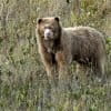 Among the top articles from our Spanish language service, Mongabay Latam, for the week of June 4 – 10 was one about a golden spectacled bear named after Paddington Bear that was caught by a camera trap for the first time in Peru. In other news, the debate on hydroelectric plants intensifies in Colombia, and […]
Super plane, satellites help map the Caribbean’s hidden coral reefs
- Satellites, aircraft and scuba divers are creating the first ever high-resolution map of coral reefs throughout the Caribbean region.
- Layers of data with 10-centimeter (4-inch) resolution will reveal the extent of damage from recent hurricanes and identify pockets of living coral to protect, as well as ailing coral that can be restored.
- The maps will be used to declare new marine protected areas, guide management plans and select areas for post-hurricane restoration.
A global coral reef monitoring system is coming soon
- Coral reef conservation efforts will soon get a major boost with a global monitoring system that will detect physical changes in coral cover at high resolution on a daily basis.
- The satellite-based system will enable researchers, policy makers, and environmentalists to track severe bleaching events, reef dynamiting, and coastal development in near-real time.
- The system will leverage Planet’s daily high resolution satellite imagery, running the data through cloud computing-based algorithms to map reefs and chart changes over time.
One-stop shop for digital global maps launched
- A new online platform called Resource Watch makes over 200 geographically referenced global-scale data sets available for viewing and analysis.
- You can view and overlay spatial data layers on your own or explore analyses produced by the platform’s research staff.
- The developers hope that assembling a broad collection of environmental, economic, infrastructure, and social data in a single platform will promote understanding of the connections between human activities and natural systems and encourage more sustainable decision-making.
Palm oil supplier to food giants clears forest, peatland in Indonesia, Greenpeace says
- The Yemen-based Hayel Saeed Anam Group, which sells palm oil to Mars, Nestlé, PepsiCo, and Unilever through subsidiaries, is responsible for clearing 40 square kilometers (15 square miles) of rainforest and peatland in Indonesia’s Papua province between 2015 and 2017, according to Greenpeace.
- Staff from the environmental organization shot video revealing the extent of the destruction.
- Greenpeace campaigners have raised concerns that Mars, Nestlé, PepsiCo and Unilever are not upholding their commitments to get rid of deforestation, peatland destruction and exploitation from their supply chains.
Rubber plantation in Cameroon edges closer to UNESCO World Heritage Site
- Satellite data indicate the rubber plantation, operated by China-owned Sud Cameroun Hévéa (Sudcam), is currently less than one kilometer away from intact primary forest habitat. Development is ongoing amidst concerns about threats to endangered species within and outside the park, as well as alleged violations of community land rights and political affiliations with the Cameroonian government.
- The expansion of this rubber plantation is “by far the most devastating new clearing of forest for industrial agriculture in the Congo Basin,” according to Greenpeace.
- Rubber expansion also stands to affect the 9,500 people who live in villages on the reserve’s periphery. According to Greenpeace Africa, Sudcam did not obtain Free and Prior Informed Consent (FPIC) from these communities before acquiring the land and residents have claimed that subsistence farmland has been taken away with little or no compensation.
- Members of the conservation community say that in order for rubber development to happen sustainably in Cameroon, companies need to collaborate with conservation NGOs to create robust buffers around wetlands and streams, develop wildlife corridors, establish areas to filter the runoff of toxins and sediment, and create bushmeat alternatives. They also recommend regulatory actions be taken in the U.S. and EU, which are major buyers of rubber.
Radar returns to remote sensing through free, near-real-time global imagery
- The European Space Agency’s launch of the Sentinel-1 satellite has made 20-meter resolution radar imagery of the whole planet freely available.
- The “all-weather, day-and-night supply of imagery of Earth’s surface” complements standard optical satellite imagery in detecting forest loss, even under heavy cloud cover.
- The Monitoring of the Andean Amazon Project (MAAP) demonstrates the benefits of analyzing free radar imagery to accurately quantify wet season loss of rainforest in the Peruvian Amazon.
Small hydropower a big global issue overlooked by science and policy
- Brazil recently announced an end to its mega-dam construction policy, a strategy other nations may embrace as understanding of the massive environmental and social impacts of big dams grows.
- However, a trend long neglected by scientists and policymakers ¬ the rapid growth of small dams – has been spotlighted in a new study.
- Nearly 83,000 small dams in 150 nations (with 11 small dams for each large dam), exist globally, while that number could triple if all capacity worldwide is used. More than 10,000 new small dams are already in the planning stages. But small dam impacts have been little studied by scientists, and little regulated by governments.
- Environmentalists say that, with the rapid construction of new small dams, it is urgent for researchers to assess the impacts of different types of small dams, as well as looking at the cumulative impacts of many small dams placed on a single river, or on main stems and tributaries within watersheds.
Oil palm, rubber could trigger ‘storm’ of deforestation in the Congo Basin
- Earthsight documented approximately 500 square kilometers (193 square miles) of deforestation to clear the way for new rubber and oil palm plantations in Central Africa’s rainforest countries in the past five years.
- The team also found that companies in five Central African countries hold licenses for industrial agriculture on another 8,400 square kilometers (3,243 square miles) of land.
- The investigators warn that thousands of hectares of forest could fall to industrial agriculture in the COngo Basin, the world’s second-largest rainforest, if governance of the forest doesn’t improve.
Audio: How effective is environmental restoration?
- How effective is environmental restoration? On today’s episode, we seek answers to that question through the lens of a much needed new project at the University of Cambridge collecting restoration evidence, and we also speak with the editor of Mongabay’s ongoing series that examines how well a range of other conservation efforts work, too.
- Our first guest today is Claire Wordley, a communications and engagement officer with the Conservation Evidence group at the University of Cambridge in the UK who recently wrote a commentary for Mongabay to alert the world to a new website called Restoration Evidence that collects research into how effective various restoration activities actually are.
- Our second guest is Mongabay’s own Becky Kessler. We’re about to bring the current reporting phase of a series called Conservation Effectiveness to a close, and because Becky has served as the head editor for the series, we wanted to have her on the Newscast to discuss some of the main findings of the series.
Penguin mega-colony discovered using satellites and drones, raising scientists’ hopes
- Scientists have discovered a mega-colony of Adélie penguins in Antarctica’s remote Danger Islands.
- The researchers utilized quadcopter drones to survey the nesting grounds in an automated manner and then used software to process the imagery for individual nests.
- The approach enabled a fast and highly accurate count relative to ground observations.
- The study validates the approach of combining satellite imagery with ground and unmanned aerial vehicle (UAV) surveys.
Andes dams twice as numerous as thought are fragmenting the Amazon
- A new study identified 142 dams currently in operation or under construction in the Andes headwaters of the Amazon, twice the number previously estimated. An additional 160 are in the planning stages.
- If proposed Andes dams go ahead, sediment transport to the Amazon floodplains could cease, blocking freshwater fish migratory routes, disrupting flow and flood regimes, and threatening food security for downstream communities, impacting up to 30 million people.
- Most dams to date are on the tributary networks of Andean river main stems. But new dams are planned for five out of eight major Andean Amazon main stems, bringing connectivity reductions on the Marañón, Ucayali and Beni rivers of more than 50 percent; and on the Madre de Dios and Mamoré rivers of over 35 percent.
- Researchers conclude that proposed dams should be required to complete cumulative effects assessments at a basin-wide scale, and account for synergistic impacts of existing dams, utilizing the UN Watercourses Convention as a legal basis for international cooperation for sustainable water management between Amazon nations.
Drought-driven wildfires on rise in Amazon basin, upping CO2 release
- Despite a 76 percent decline in deforestation rates between 2003 and 2015, the incidence of forest fires is increasing in Brazil, with new research linking the rise in fires not only to deforestation, but also to severe droughts.
- El Niño, combined with other oceanic and atmospheric cycles, produced an unusually severe drought in 2015, a year that saw a 36 percent increase in Amazon basin forest fires, which also raised carbon emissions.
- Severe droughts are expected to become more common in the Brazilian Amazon as natural oceanic cycles are made more extreme by human-induced climate change.
- In this new climate paradigm, limiting deforestation alone will not be sufficient to reduce fires and curb carbon emissions, scientists say. The maintenance of healthy, intact, unfragmented forests is vital to providing resilience against further increases in Amazon fires.
Coral reef monitoring takes to the skies: drone-mounted hyperspectral cameras help scientists assess health of coral reefs
- Hyperspectral images taken from cameras on unmanned aerial vehicles (UAVs) are helping scientists survey the composition and health of coral reefs under the water.
- These images capture information from visible (light) and non-visible sections of the electromagnetic spectrum thereby offering information the human eye can’t see.
- When paired with UAVs or satellites, hyperspectral images allow researchers to survey the reef habitats–including coral, sand, and algae–over large areas as well as monitor the health of individual corals.
Deforestation in the Peruvian Amazon dropped 13 percent in 2017
- A new analysis of satellite imagery and data finds 143,425 hectares of forest were lost in the Peruvian Amazon in 2017, down 13 percent from 2016.
- The analysis identified newly deforestation hotspots in the San Martín and Amazonas regions.
- The main causes of the loss of forest in the Amazon appear to be cultivation of crops, small- and medium-scale ranching, large oil palm plantations and gold mining.
Drones enable fast, accurate wildlife counts, study shows
- Unmanned aerial vehicles (UAVs) have great potential for surveying wildlife, especially species that assemble in large numbers and that are easily disturbed by human presence.
- Scientists creatively combined high-tech UAVs and computer-vision algorithms with rubber ducks to assess the potential of aerial imagery to count seabirds relative to traditional survey methods.
- They found that both human and semi-automated computer counts of colony-nesting birds from UAV-derived images were more accurate and less variable than counts made by observers on the ground.
- Combining UAV-derived imagery with artificial intelligence can help scientists more accurately estimate population sizes with less variability.
Cattle invade Colombian national park
- An analysis of satellite data shows incursions into La Paya National Park in southern Colombia.
- The data indicate La Paya lost around 9,500 hectares of rainforest between 2001 and 2016.
- Researchers say satellite imagery show evidence that these clearings are being used for cattle pasture.
- Conservationists worry deforestation will continue to rise with the demobilization of Colombia’s FARC rebel group, whose presence in the country’s forests kept logging and agriculture at bay for decades.
Carbon pricing could save millions of hectares of tropical forest: new study
- Recently published research in the journal Environmental Research Letters found that setting a price of $20 per metric ton (about $18/short ton) of carbon dioxide could diminish deforestation by nearly 16 percent and the amount of carbon released into the atmosphere by nearly 25 percent.
- The pair of economists calculated that, as things currently stand, the world stands to lose an India-size chunk of tropical forest by 2050.
- In addition to carbon pricing, stricter policies to halt deforestation, such as those that helped Brazil cut its deforestation rate by 80 percent in the early 2000s, could save nearly 1 million square kilometers (386,000 square miles).
Amazon rainforest hit by surge in small-scale deforestation, study finds
- A recent study used high-resolution satellite imagery to analyze deforestation events in Amazonia, uncovering a shift from large- to small-scale deforestation events across the region. Protected areas also appear to be affected.
- The results indicate big new deforestation hotspots are opening up in Peru and Bolivia, likely caused by industrial agriculture.
- The researchers found 34 percent of forest loss patches in the Brazilian Amazon were smaller than 6.25 hectares, which is the smallest size detectable by the Brazilian government’s deforestation monitoring system.
- The researchers say higher-resolution monitoring systems are needed to combat the rising tide of small-scale deforestation.
Maps tease apart complex relationship between agriculture and deforestation in DRC
- A team from the University of Maryland’s GLAD laboratory has analyzed satellite images of the Democratic Republic of Congo to identify different elements of the “rural complex” — where many of the DRC’s subsistence farmers live.
- Their new maps and visualizations allow scientists and land-use planners to pinpoint areas where the cycle of shifting cultivation is contained, and where it is causing new deforestation.
- The team and many experts believe that enhanced understanding of the rural complex could help establish baselines that further inform multi-pronged approaches to forest conservation and development, such as REDD+.
Zero-deforestation pledges need help, support to meet targets, new study finds
- The study’s authors reviewed previous research to understand the impact that zero-deforestation commitments are having on reducing the loss of forests.
- Nearly 450 companies made 760 such commitments by early 2017.
- These pledges can reduce deforestation in some cases, but in others, they weren’t effective or had unintended effects, according to the study.
- The authors advocate for increased public-private communication, more support for smallholders, and complementary laws that support these pledges.
Data fusion opens new horizons for remote imaging of landscapes
- Scientists use remotely sensed data from satellites to map and analyze habitat extent, vegetation health, land use change, and plant species distributions at various scales.
- Open-source data sets, analysis tools, and powerful computers now allow scientists to combine different sources of satellite-based data.
- A new paper details how combining multispectral and radar data enables more refined analyses over broader scales than either can alone.
Feeds: news | india | latam | brasil | indonesia